


+ 45
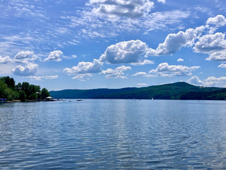
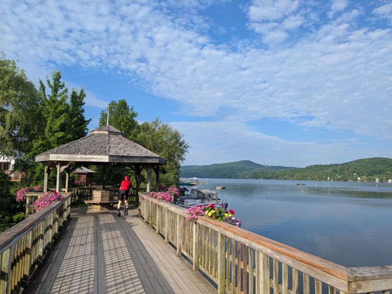
North Hatley and Ayer's Cliff
自行車路線
詳細資訊
66.26 公里
815 公尺
Cette route passe par l'un des plus beaux villages du Québec: North Hatley. Ce petit village sur le lac Massawippi est le parfait endroit pour prendre une pose. This route pass by one of the most beautiful village of the province of Quebec. This small village is the perfect place for taking a break.
路線和海拔
路段
| 名稱 | 距離 | 海拔差異 | 平均坡度 |
|---|---|---|---|
| Montée Merry courte | 1.31 公里 | 15 公尺 | 0.8% |
| Rue Merry N | 0.94 公里 | 28 公尺 | 3.0% |
| Côte du chemin de la Côte (Magog>) | 1.44 公里 | 51 公尺 | 3.5% |
| Montée Ste-Catherine | 1.01 公里 | 95 公尺 | 9.3% |
| Ste-Catherine-de-Hatley à North Hatley | 6.79 公里 | -150 公尺 | -2.0% |
| Descente Manoir Hovey | 3.51 公里 | -149 公尺 | -4.0% |
| Descente vers pont | 1.89 公里 | -120 公尺 | -6.3% |
| slingshot | 0.52 公里 | 32 公尺 | 6.0% |
| Chemin Sherbrooke Climb | 1.93 公里 | 89 公尺 | 4.6% |
| Chemin Sherbrooke - Short | 0.67 公里 | 51 公尺 | 7.7% |
| Chemin Sherbrooke complet | 2.92 公里 | 87 公尺 | 3.0% |
| 143 sherbrooke-olivier | 4.68 公里 | 25 公尺 | 0.2% |
| 143 N-S (NH - Massawipi) | 10.22 公里 | -47 公尺 | -0.2% |
| route 143 | 3.11 公里 | 35 公尺 | 0.4% |
| Toboggan vers Ayer's Cliff | 4.06 公里 | -68 公尺 | -1.5% |
| 141 Slack Bay | 2.51 公里 | 14 公尺 | 0.2% |
| Mtéé Rte 141 (Aut 55) | 2.01 公里 | 56 公尺 | 2.8% |
| Mtée 141 du Ch. Ayer's Cliff | 1.88 公里 | 50 公尺 | 2.6% |
| 141 TT | 10.63 公里 | 113 公尺 | 0.5% |
| 141 Climb | 4.12 公里 | 113 公尺 | 2.7% |
| ROUTE 141(chemin ayers cliff) | 7.11 公里 | 93 公尺 | 1.3% |
| Chemin Ayers cliff | 9.21 公里 | 54 公尺 | 0.1% |
| Défi Félix - 2018 (segment 2) | 3.87 公里 | -60 公尺 | -1.5% |
| just' la fin | 3.73 公里 | -60 公尺 | -1.5% |