| Pleasanton Sprint | 0.42 mi | 30 ft | 0.3% |
| Foothill south Stoneridge to Muirwood | 0.38 mi | 59 ft | 2.7% |
| Muirwood to Foothill Climb | 0.28 mi | 79 ft | 5.2% |
| Foothill High southbound bump | 0.39 mi | 52 ft | 2.5% |
| Foothill Rd [Southbound] - Foothill High School Climb | 0.20 mi | 30 ft | 2.7% |
| Bernal to Castlewood sprint | 1.53 mi | -43 ft | -0.4% |
| first segment sunol climb | 0.30 mi | 59 ft | 3.6% |
| Up and into Sunol from P-Town | 1.39 mi | -108 ft | -0.2% |
| Sunol Climb | 0.65 mi | 82 ft | 2.4% |
| Niles Canyon Sunol-Palomares | 3.96 mi | -89 ft | -0.4% |
| Ventosa Bridge | 0.29 mi | 23 ft | 0.8% |
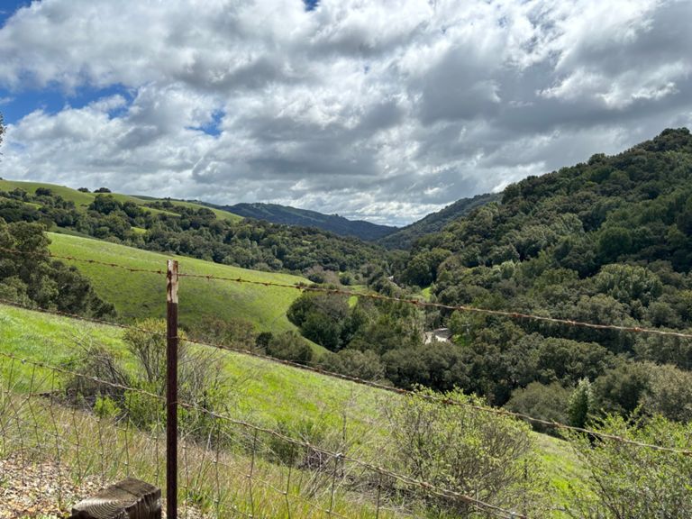
| Palomares All, not half, the whole Gawd Damn Road! | 9.71 mi | 1,056 ft | 0.4% |
| Palomares 1/2 way up from Niles. | 2.30 mi | 656 ft | 5.4% |
| Palomares Road from Niles Canyon (Low-Key Hillclimbs) | 4.52 mi | 1,060 ft | 4.4% |
| Palomares Rd Climb | 0.93 mi | 289 ft | 5.8% |
| Palomares Rd Climb [Northbound] - Middle Snippet | 0.59 mi | 325 ft | 10.2% |
| Palomeras north mid section | 1.98 mi | 269 ft | 2.5% |
| Palomares Road Climb | 0.65 mi | 394 ft | 11.4% |
| Palomares Rd Descent [Northbound] - Steep Start | 1.16 mi | -502 ft | -8.2% |
| Palomares Rd Descent [Northbound] - Start Below Summit | 4.84 mi | -771 ft | -3.0% |
| Palomares Rd north Sprint - Long | 0.39 mi | -26 ft | -0.1% |
| Palomares Rd [Northbound] - Sprint Finish | 0.20 mi | -13 ft | -0.9% |
| E. CV Blvd | 0.75 mi | 85 ft | 1.6% |
| Hill of Hate 2 | 0.47 mi | 154 ft | 6.2% |
| Hill of Love Downhill | 0.68 mi | -171 ft | -4.8% |
| Golf Course to Pinehurst | 7.63 mi | 669 ft | 0.6% |
| Redwood to Skyline | 8.98 mi | 712 ft | 1.5% |
| Redwood climb to Marciel | 2.47 mi | 591 ft | 4.4% |
| Redwood sprint to 20 | 0.18 mi | 46 ft | 4.9% |
| Redwood Interval | 1.04 mi | 325 ft | 5.9% |
| k lets go | 0.86 mi | 243 ft | 5.3% |
| Marciel Sprint: Northbound | 0.31 mi | -26 ft | -0.5% |
| Redwood Road Marciel to Pinehurst | 3.99 mi | -430 ft | -1.7% |
| Redwood Rage | 0.17 mi | 13 ft | 0.7% |
| Redwood Rd Descent Northbound | 1.28 mi | -253 ft | -3.6% |
| Bort Meadow to Pinehurst | 1.85 mi | -161 ft | -1.4% |
| Redwood Rd (true Pinehurst intersection to Skyline) | 2.39 mi | 453 ft | 3.5% |
| RW Rd from Pinehurst to mirror | 1.56 mi | 230 ft | 2.8% |
| Redwood Rd. Hill | 0.60 mi | 177 ft | 5.5% |
| Stud Farm or Put Out to Pasture Horse Stable Test | 0.19 mi | 69 ft | 6.8% |
| SKYLINE REDWOOD ROLL | 0.51 mi | 125 ft | 4.6% |
| Joaquin Miller Meadow to Fwy | 0.77 mi | -397 ft | -9.7% |
| Mountain from JM to Ascot | 0.57 mi | -138 ft | -2.1% |
| Tribble probe return | 0.28 mi | -69 ft | -3.5% |
| Montclair underbelly (Park to Thornhill) | 0.79 mi | 85 ft | 1.7% |
| Lucky Sprint | 0.45 mi | 46 ft | 1.0% |
| Thornhill To Top of Broadway Terrace | 1.07 mi | -85 ft | -0.6% |
| Brdwy Terrace Hump | 0.24 mi | 43 ft | 0.8% |
| Lower Broadway Terrace Descent | 1.34 mi | -351 ft | -5.0% |
| Broadway Terrace | 0.48 mi | -26 ft | -0.9% |