| Minute Mash | 0.66 mi | 200 ft | 5.7% |
| Minuteman to Chevron | 0.72 mi | 207 ft | 5.4% |
| Pioneer Rd Round About just past Chevron | 0.23 mi | 82 ft | 6.6% |
| Wasatch North Light to Light | 4.38 mi | 525 ft | 2.2% |
| The Whole Wasatchilada | 14.05 mi | 499 ft | 0.3% |
| All I wanted was a Pepsi | 1.21 mi | 269 ft | 4.1% |
| Wasatch Blvd - Top Half of B!#$H Hill | 0.30 mi | 118 ft | 7.2% |
| Church to Light | 2.43 mi | 141 ft | 0.9% |
| 10025 S to Little Cottonwood Rd | 0.33 mi | 79 ft | 4.0% |
| 3500 E-Wasatch to Big Cottonwood | 1.14 mi | -102 ft | -0.8% |
| Mouth BC to 45th | 4.18 mi | 128 ft | 0.1% |
| BCC to Emi | 10.65 mi | 174 ft | 0.0% |
| BCC Mouth to Millcreek City Sign | 1.10 mi | -102 ft | -1.4% |
| Wasatch Blvd NorthBound | 5.09 mi | 180 ft | 0.5% |
| 5k TT Fitness Test | 2.91 mi | 102 ft | 0.3% |
| Wasatch/Old Mill Sprint | 1.47 mi | -30 ft | -0.3% |
| wasatch - olympus trailhead | 0.89 mi | -10 ft | -0.1% |
| Mt. Olympus Trailhead to 4500 S | 1.52 mi | 121 ft | 1.4% |
| einstein/emigration | 13.16 mi | 1,447 ft | 1.8% |
| Milly to Little Mtn | 13.08 mi | 1,424 ft | 1.9% |
| MillcreekToEmigrationCreek | 5.03 mi | 154 ft | 0.2% |
| Commute Hill Finishing Sprint | 0.33 mi | 46 ft | 2.5% |
| Parley's crossing - flat | 0.71 mi | -105 ft | -0.5% |
| Parley's Crossing North Bound Climb | 0.21 mi | 79 ft | 6.8% |
| Foothill Dr | 1.14 mi | -33 ft | -0.2% |
| Bonneville Split | 0.71 mi | 144 ft | 3.8% |
| Golf Course Climb | 0.42 mi | 108 ft | 4.8% |
| Crestview Dr. Hill-climb Sprint | 0.14 mi | -36 ft | -4.4% |
| Crestview Dr to Ruth's Diner | 1.94 mi | 266 ft | 2.6% |
| Emigration Base to Fire Station | 3.30 mi | 463 ft | 2.5% |
| Zoo to Ruth's | 1.91 mi | 256 ft | 2.5% |
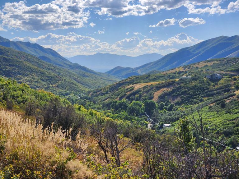
| Emigration Canyon (Little Mountain Summit) | 7.59 mi | 1,293 ft | 3.2% |
| Ruths to Switchbacks | 3.99 mi | 617 ft | 2.9% |
| Emigration Canyon Climb | 1.07 mi | 466 ft | 8.2% |
| Final Climb | 1.63 mi | 381 ft | 4.4% |
| Parley's Canyon | 5.28 mi | 1,309 ft | 4.7% |
| Lambs to Parley's Summit | 2.92 mi | 846 ft | 5.4% |
| Summit Park descent | 2.40 mi | -466 ft | -3.7% |
| 224 sprint. Catholic church to median just past white barn | 0.62 mi | 33 ft | 0.7% |
| School Light to 40 | 1.96 mi | -102 ft | -1.0% |
| Victory Hwy Climb | 1.67 mi | 331 ft | 3.7% |
| Midway to Vivian Park | 15.59 mi | -404 ft | -0.5% |
| wish there was a bike lane 113 | 0.57 mi | -7 ft | -0.2% |
| Deer Creek Dam Down to Vivian | 4.78 mi | -249 ft | -0.9% |
| Vivian to Mouth HWY | 4.59 mi | -377 ft | -1.2% |
| AF Temple Hill Sprint- 1100 E NB | 0.42 mi | 95 ft | 4.2% |
| LPHS to Timp Hwy | 0.99 mi | 69 ft | 1.3% |
| hill sprint back to alpine | 0.11 mi | 26 ft | 3.6% |
| Westfield to 6000 W | 1.12 mi | -49 ft | -0.8% |
| Ridgeline Fly By Sprint | 0.66 mi | 0 ft | 0.0% |