Past Month


+ 74
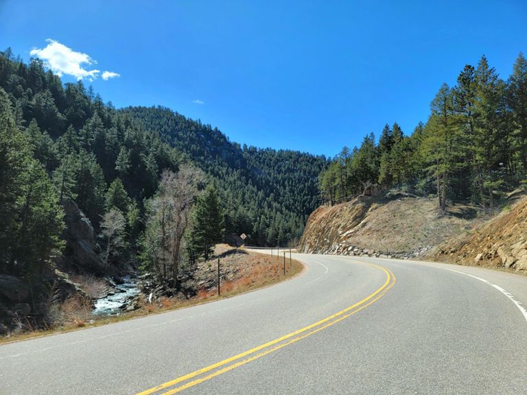
St. Vrain + Peak to Peak Loop
Cycling Route
Details
65.62 mi
5,575 ft
Considered by many to be one of the best rides in the country, the St. Vrain + Peak to Peak Loop (also known as the Ward-Lyons Loop) takes cyclists from Boulder all the way up to the oft snowy Peak to Peak. From Boulder, riders are able to warm up along Hwy 36 while heading north towards Lyons before the hard climbing begins. Although this loop can be ridden in either direction, most cyclists prefer turning left onto CO 7 from Lyons. A lengthy and visually striking climb, cyclists will admire the granite and red sandstone walls that surround them. Stop off at the Raymond General Store for a drink before reaching the renowned Peak to Peak Highway. You’ll continue climbing rollers all the way until you arrive at the town of Ward, where there is another opportunity to stop for snacks and refreshments. At this point, riders can finally take a deep breath; the climbing is over. All that’s left is a long and flowing descent down Lefthand Canyon and an easy stretch back to downtown Boulder.
* Starting from Boxcar Coffee Roasters
Created By
Quinton Vance
