Strava
Mobile
Features
Subscribe
Maps
Stories
Sign Up
Log In
Past Two Weeks
Past Month
+ 49
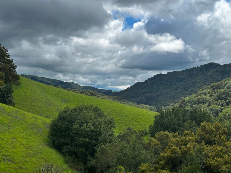
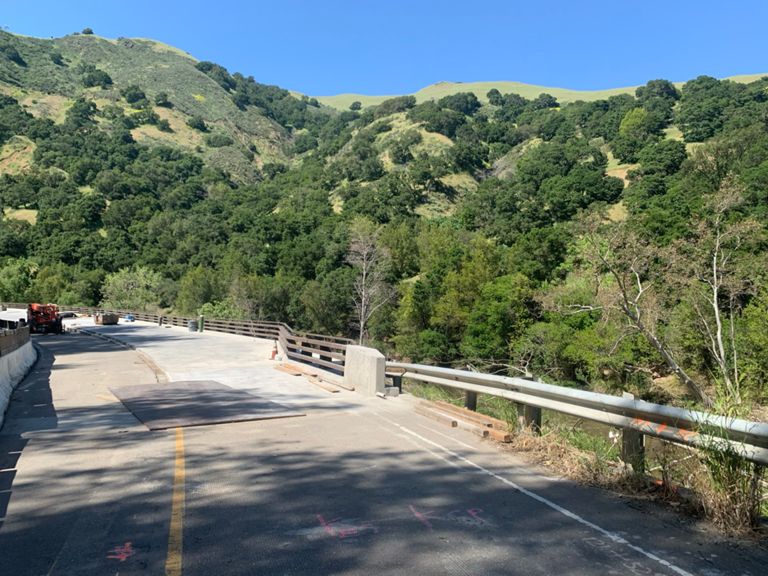
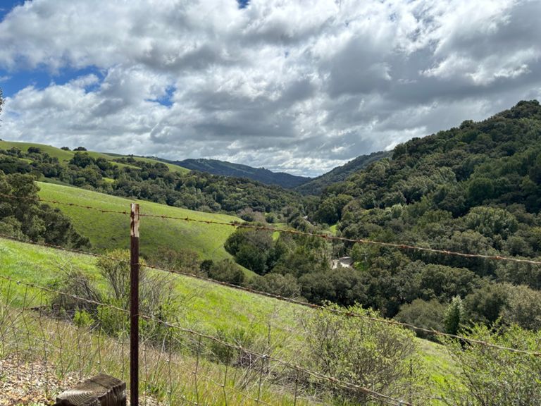
Pine Valley - Palamares Canyon-Kilgare- Foothill-IR Trail
Cycling Route
Save
Share
Embed
Copy URL
Export TCX
Export GPX
Print
Details
41.13 mi
2,932 ft
Beautiful Backyard 2
Created By
Tony Babasa
September 27, 2014
·
Public
Route and Elevation
Segments
Name
Distance
Elev. Diff.
Avg. Grade
silvergate dr Eb
1.15 mi
92 ft
1.2%
Dublin Blvd. - Stairway to Schaefer Ranch
1.87 mi
456 ft
4.6%
Silvergate to Inspiration Circle
0.60 mi
108 ft
3.4%
Dublin Blvd - Inspiration to Marshall
1.23 mi
308 ft
4.7%
Inspiration to Eden Canyon
3.95 mi
-433 ft
-0.7%
Schaefer Ranch Rd Descent
0.30 mi
-180 ft
-11.4%
Dublin Cyn westbound
2.32 mi
-292 ft
-2.4%
Palomares All, not half, the whole Gawd Damn Road! (North to South)
9.73 mi
-1,102 ft
-0.4%
Palomares full climb
5.13 mi
892 ft
3.3%
Palomares N - easy pahts
3.99 mi
384 ft
1.8%
Palomares Climb South
5.05 mi
883 ft
3.3%
Palomares Road - Northside Climb
5.05 mi
886 ft
3.3%
Palomares Rd North side
5.00 mi
896 ft
3.4%
Palomares Rd [Southbound]
5.00 mi
892 ft
3.4%
Last stretch to Goats
1.33 mi
279 ft
3.8%
Beat Hanns D. Segment
1.16 mi
509 ft
8.3%
Palomares, south
1.13 mi
-1,421 ft
-0.0%
Steep Section to fence
1.03 mi
469 ft
8.6%
The Pain of Palomares
0.91 mi
430 ft
8.9%
Palomares Decent (Southside - Summit to Niles Canyon Rd)
4.61 mi
-994 ft
-4.1%
Palomares Descent (Southbound)
4.49 mi
-1,040 ft
-4.4%
Niles Canyon East (Palomares to Sunol)
3.91 mi
108 ft
0.5%
Kilkare Rd. Climb
3.59 mi
666 ft
3.5%
Kilkare to Wall
1.27 mi
184 ft
2.7%
Kilkare Road
3.02 mi
633 ft
4.0%
Kilkare Descent - Full
3.41 mi
-617 ft
-3.4%
Kilkare Descent
3.10 mi
-538 ft
-3.3%
Sunol Train Station uphill climb long
1.38 mi
115 ft
0.5%
Sunol / Foothill Mini-KOM
0.61 mi
108 ft
3.2%
Verona to Happy Valley Sprint
0.70 mi
3 ft
0.1%
Foorhill - Castlewood to Bernal
1.41 mi
36 ft
0.4%
Foothill Bernal to peak
1.10 mi
98 ft
1.6%
Foothill Rd — Bernal Av. to Stoneridge Rd.
2.72 mi
95 ft
0.2%
Foothill Bernal 2 Las Positas
1.58 mi
89 ft
0.7%
Attack Attack Attack
0.12 mi
26 ft
4.1%
Foothill rd to Muirwood uphill attack
0.33 mi
66 ft
3.6%
Stoneridge - 680 Overpass
0.37 mi
-23 ft
-0.3%
Alamo Canal Trail from Stoneridge Dr to Iron Horse
1.63 mi
23 ft
0.3%
Alamo Creek to Iron Horse Trail Dublin Blvd to Amador Valley Blvd
0.80 mi
23 ft
0.5%
Amador Valley Blvd - Village Parkway to Donohue Dr
0.28 mi
10 ft
0.3%