| B&Q to PO | 0.29 英里 | -3 呎 | -0.3% |
| Jump Jam Bend | 0.20 英里 | 7 呎 | 0.4% |
| Brizzys tes backwards | 0.16 英里 | -3 呎 | 0.0% |
| St Mary Hill Climb | 0.36 英里 | 138 呎 | 7.1% |
| City Inn Fields Climb no GPS drift | 0.27 英里 | 30 呎 | 2.1% |
| Watery Lane Dash | 0.72 英里 | 135 呎 | 3.5% |
| Maendy Road to A48 | 2.57 英里 | 289 呎 | 1.7% |
| Mid Watery Lane | 0.74 英里 | 138 呎 | 3.5% |
| Run from the Doughnuts | 0.83 英里 | -59 呎 | -0.3% |
| Christmas Tree Lump | 0.25 英里 | 39 呎 | 2.9% |
| Bonvilston kicker | 0.61 英里 | 46 呎 | 1.2% |
| Caemaen Rise | 0.17 英里 | 49 呎 | 5.2% |
| The Chase!! | 1.69 英里 | -121 呎 | -1.2% |
| The JVN Rink a Dink Dinker bend | 0.69 英里 | -59 呎 | -1.6% |
| Llancarfan climb to Kenson river | 1.08 英里 | 174 呎 | 3.0% |
| up from Llancarfan | 0.11 英里 | 39 呎 | 6.6% |
| Monster Mountain | 0.18 英里 | 49 呎 | 4.9% |
| Pedlads thru Portkerry Park, Airfield to Barry | 1.48 英里 | 161 呎 | 0.3% |
| Porthkerry Hill | 0.28 英里 | 82 呎 | 5.3% |
| To the beach | 0.48 英里 | -46 呎 | -1.3% |
| Escape from Barrybados | 0.57 英里 | 72 呎 | 1.8% |
| Barry Island Sprint | 0.39 英里 | 23 呎 | 0.2% |
| Ship Hill Barry | 0.10 英里 | 43 呎 | 7.8% |
| Ship Hill to Park Road | 0.36 英里 | 115 呎 | 6.0% |
| Pedlads thru Porthkerry Park, Barry to Airfield | 1.50 英里 | -167 呎 | -0.4% |
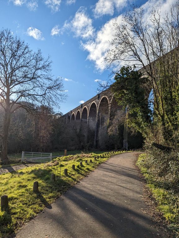
| Viaduct View Climb | 0.27 英里 | 125 呎 | 8.5% |
| Inn to Inn | 1.23 英里 | -39 呎 | -0.3% |
| Ffontygary to Coast Road | 1.91 英里 | -92 呎 | -0.8% |
| 'S' Bend - Up hill short and sharp | 0.47 英里 | 43 呎 | 1.4% |
| Gileston dog leg | 0.77 英里 | 59 呎 | 0.9% |
| brizzys smashing up St Athan | 0.29 英里 | -10 呎 | -0.0% |
| St Athan dipper and climb | 0.49 英里 | 66 呎 | 1.5% |
| St Athan Road | 1.29 英里 | 56 呎 | 0.6% |
| St Mary Roller Coaster | 3.48 英里 | -171 呎 | -0.0% |
| Newbarn to the crossroads | 0.51 英里 | 30 呎 | 0.9% |
| St Marys Grind | 0.20 英里 | 85 呎 | 8.0% |
| Down, then up to Cowbridge | 0.60 英里 | -138 呎 | -2.1% |
| Col de Caldicott | 0.12 英里 | 62 呎 | 9.2% |
| Bridgy Cow | 0.63 英里 | -39 呎 | -0.8% |
| Climb from Cowbridge | 0.51 英里 | 131 呎 | 4.8% |
| Rise to Pentre Meyrick | 0.25 英里 | 59 呎 | 4.4% |
| Pentre Meyrick Sprint | 0.65 英里 | -16 呎 | 0.0% |
| A48 up | 0.96 英里 | 46 呎 | 0.9% |
| Hang on | 1.51 英里 | -259 呎 | -3.2% |
| just let go | 0.31 英里 | -164 呎 | -9.4% |
| Pedal hard | 1.03 英里 | -75 呎 | -1.3% |
| TES sprint for the finish | 0.19 英里 | -3 呎 | -0.1% |
| Starbucks Sprint | 0.22 英里 | -3 呎 | -0.1% |
| Singleton to Roundabout Dash | 0.87 英里 | 49 呎 | 0.7% |
| Brackla way 1st | 0.19 英里 | 46 呎 | 4.4% |