route-highlight
route-highlight
route-highlight
route-highlight
route-highlight
route-highlight
+ 194

Segment A - Run Around Toronto

Ruta para correr

Moderada
35,34 km
291 m
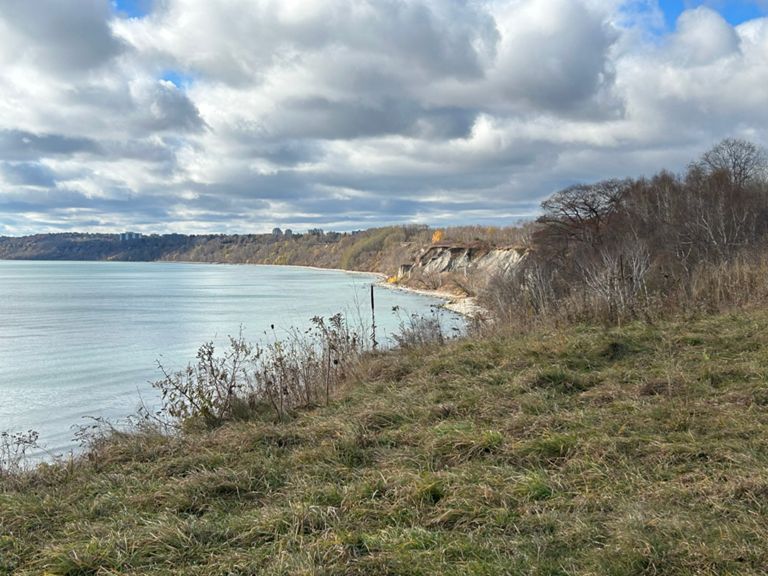
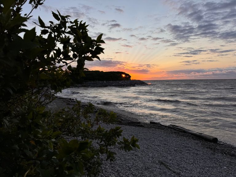
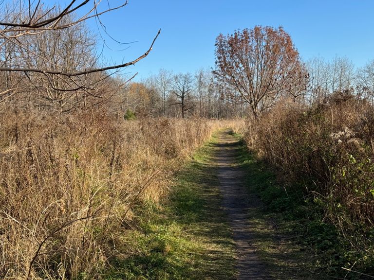
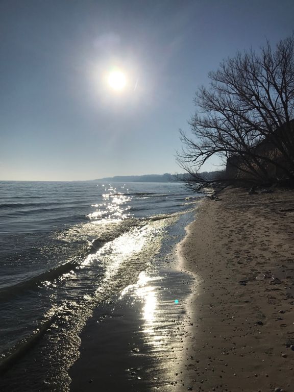
Starting at the foot of Yonge, moving east along the Martin Goodman Trail (paved multi-use), continue through the port lands past Cherry Beach, but not going into Tommy Thompson, back on MG to the boardwalk in The Beach, continue to the Water treatment plant then, work up towards Kingston Road towards Scarborough Bluffs, then back up to Kingston road briefly before going down Doris McCathy Trail (mostly hard packed gravel) to the Lake then eastward. Then a **3K beach section over mostly sand and some bouldering**, before hitting pavement of the Waterfront Trail, which goes the remainder of the way to Rouge Beach.

- Gas Station at the 22K mark, before descending DM Trail
Creada por
Mark Carey

Ruta y desnivel

Segmentos

NombreDistanciaDiferencia de desnivelPendiente media
Queens Quay East footpath1,87 km-3 m-0,2 %
Waterfront - Sherbourne to Draw Bridge1,10 km-12 m-0,1 %
Waterfront Trail - Parliament to Draw Bridge0,57 km0 m0,0 %
Cherry St, Southbound1,27 km0 m0,0 %
Commissioners to Unwin0,83 km0 m0,0 %
Cherry Beach to Leslie2,56 km0 m0,0 %
Cherry Beach path East1,78 km0 m0,0 %
Martin Goodman Trail - Bridge to TTP Gate0,79 km3 m0,4 %
Leslie St, Unwin to Lakeshore (NB)0,78 km0 m0,0 %
LeslieToBalmyBeach3,51 km5 m0,0 %
My Beach Run2,84 km5 m0,1 %
Bikepath to Silverbirch2,46 km1 m0,0 %
Bathing Station to Kew0,93 km0 m0,0 %
Pool to Court Sprint0,32 km0 m0,0 %
Pool to end of boardwalk1,73 km1 m0,0 %
March Miles Madness NB 4 Bored of walking2,13 km-9 m-0,1 %
Kew to the End of the Boradwalk1,12 km1 m0,0 %
Courcelette Road Climb0,34 km42 m12,3 %
Fallingbrook Drive Trudge0,27 km31 m11,4 %
Kingston: Fallingbrook to Valhalla1,19 km4 m0,2 %
Kingston Rd-->waterfront trail0,55 km0 m0,0 %
Glen Everest to Fishleigh Sprint0,27 km2 m0,3 %
Fishleigh: Glen Everest to Midland0,79 km-8 m-0,9 %
100 meter dash! Midland: Fishleigh to Romana0,18 km4 m2,1 %
Brimley Road South Climb0,61 km52 m8,4 %
Down and up0,29 km-1 m-0,3 %
Highland Creek to Rouge River3,78 km-9 m-0,2 %
To the beach sprint1,77 km-4 m-0,1 %