| Heading down down baby | 0.19 英里 | -20 呎 | -1.9% |
| East river heliport to 14th st. | 1.06 英里 | 3 呎 | 0.0% |
| Stuy Slooze | 0.67 英里 | -3 呎 | -0.0% |
| BP to The Narrows | 0.53 英里 | -3 呎 | 0.0% |
| Captain Patrick J. Brown Boardwalk | 0.28 英里 | 10 呎 | 0.0% |
| East river 14th esplanade north section | 0.37 英里 | 0 呎 | 0.0% |
| Bridge to Bridge Dash | 0.21 英里 | -3 呎 | 0.0% |
| Delancey, East River - Clinton St | 0.47 英里 | 20 呎 | 0.8% |
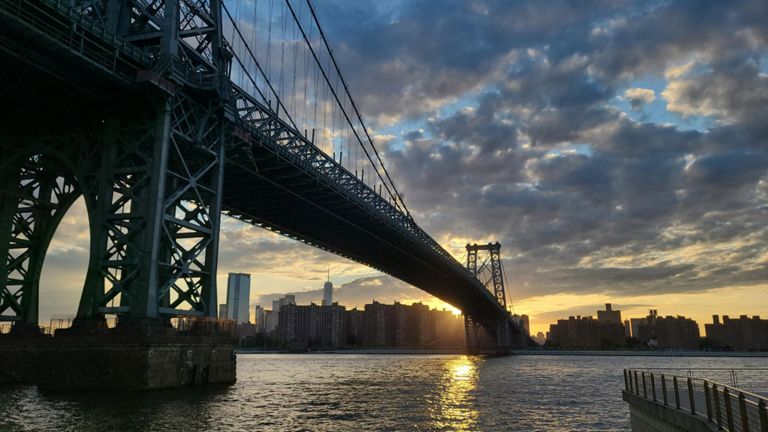
| Williamsburg Bridge Eastbound Full Climb | 0.76 英里 | 128 呎 | 3.2% |
| Williamsburg Bridge Hill Climb - Manhattan Side | 0.43 英里 | -20 呎 | -0.8% |
| 1 min Wburg bridge hill run | 0.21 英里 | -10 呎 | -0.9% |
| Williamsburg bridge, eastbound. | 1.20 英里 | 151 呎 | 0.4% |
| Williamsburg Bridge (Manhattan to Brooklyn) | 1.14 英里 | 46 呎 | 0.4% |
| Grocery to Gas Station | 0.81 英里 | -7 呎 | -0.0% |
| Trash Alley South | 0.19 英里 | 7 呎 | 0.6% |
| Naval Cemetery Straight S | 0.16 英里 | 10 呎 | 1.1% |
| Flushing Flats | 0.91 英里 | 121 呎 | 0.4% |
| Steiner to Navy Dash | 0.69 英里 | -7 呎 | -0.1% |
| Up Navy from Flushing to Front | 0.27 英里 | 30 呎 | 1.9% |
| Park it south | 0.74 英里 | -7 呎 | -0.0% |
| Pier 1 to Pier 6 drag | 0.54 英里 | 3 呎 | 0.1% |
| Brooklyn Bridge Park: Pier 2 to Pier 3 Hill | 0.16 英里 | 3 呎 | 0.2% |
| Pier 2 to Pier 5 inner path | 0.30 英里 | -3 呎 | -0.1% |
| Brooklyn Bridge Park: Pier 3 to Pier 4 | 0.19 英里 | -3 呎 | 0.0% |
| Columbia waterfront long dash | 0.82 英里 | 7 呎 | 0.0% |
| Finding Tempo to Red Hook | 0.36 英里 | 7 呎 | 0.1% |
| Degraw to Carroll bike path | 0.33 英里 | -10 呎 | -0.3% |
| Imlay SW | 0.37 英里 | -7 呎 | -0.0% |
| Ikea trail | 0.51 英里 | 3 呎 | 0.0% |
| fishy 400 | 0.31 英里 | -3 呎 | -0.1% |
| Gowanus Arm | 0.75 英里 | -0 呎 | -0.0% |
| Red Hook Sprint reverse dir. | 0.64 英里 | 39 呎 | 0.1% |