| dash to daytoon | 1.30 mi | -39 ft | -0.5% |
| Silver Creek Climb | 0.20 mi | 75 ft | 6.8% |
| Thomas Spring | 0.54 mi | 154 ft | 5.4% |
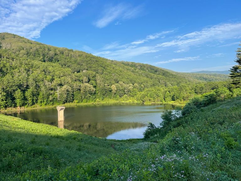
| To the Reservoir | 5.18 mi | 735 ft | 2.7% |
| The Branch to Tilghman | 2.89 mi | 236 ft | 1.5% |
| Brierly Branch to Saddle | 9.50 mi | 2,201 ft | 4.4% |
| Brierly Branch to Flag Pole Knob | 12.92 mi | 2,867 ft | 4.2% |
| Hone Quarry entrance to Flagpole Summit | 10.76 mi | 2,687 ft | 4.7% |
| Tilghman rd to Marker 6 | 3.04 mi | 423 ft | 2.6% |
| Tilghman to Saddle | 6.72 mi | 1,959 ft | 5.5% |
| Branch Lake Climb | 2.38 mi | 331 ft | 2.6% |
| Briery Branch Rd Climb | 1.70 mi | 302 ft | 3.4% |
| Flagpole Knob Climb | 9.84 mi | 2,589 ft | 5.0% |
| Briery Branch Road Climb | 1.01 mi | 282 ft | 5.3% |
| Reddish Knob Ascent (Reservoir to State Line Turn) | 4.32 mi | 1,699 ft | 7.4% |
| Briery Branch Gap East. | 3.93 mi | 1,558 ft | 7.5% |
| Briery Branch Rd Steep | 3.90 mi | 1,552 ft | 7.5% |
| Marker 6 to Marker 5 | 1.07 mi | 384 ft | 6.7% |
| Briery Branch Road Climb | 0.88 mi | 315 ft | 6.8% |
| Marker 5 to Marker 4 | 2.11 mi | 860 ft | 7.7% |
| Briery Branch Rd Climb | 1.54 mi | 659 ft | 8.1% |
| Almost There | 1.45 mi | 699 ft | 9.1% |
| Forest Road 85 A to Flag pole | 3.30 mi | 682 ft | 3.9% |
| Forest Road 85 A to Meadow Knob | 5.05 mi | 620 ft | 0.6% |
| Forest Road 85 A Climb | 1.71 mi | 404 ft | 4.4% |
| Chunky Downhill Jeep Trail | 1.11 mi | -364 ft | -4.6% |
| meadow down | 0.97 mi | -358 ft | -6.9% |
| Meadow knob to Pond knob | 0.90 mi | -351 ft | -6.2% |
| Meadow to Oak | 1.92 mi | -584 ft | -3.6% |
| Mud Pond Six Pack | 2.57 mi | -1,329 ft | -9.8% |
| Oak Knob to Mud Pond | 1.17 mi | -663 ft | -10.7% |
| MUD POND TO STREAM | 1.40 mi | -666 ft | -9.0% |
| Downhill From Mud Pond | 1.57 mi | -689 ft | -8.3% |
| Just the Tip | 0.46 mi | 108 ft | 4.3% |
| Union Springs Up and Over TT | 1.84 mi | -161 ft | -0.6% |
| Horeb Church Double Decker High Point | 0.61 mi | 26 ft | 0.2% |
| Heart 2 | 5.51 mi | 285 ft | 0.1% |
| Hinton to Bank Church Climb | 0.89 mi | 115 ft | 2.1% |
| Mole Hill Back Side | 0.51 mi | 141 ft | 5.2% |
| Alpine Loop 2018 Mole Hill Exactamente | 0.31 mi | 115 ft | 6.9% |
| Mole Hill Front Side Descent | 0.98 mi | -269 ft | -5.2% |
| Mole Hill Southeast Descent | 0.88 mi | -259 ft | -5.6% |
| Ol 33 to Belmont Dr | 0.42 mi | 75 ft | 2.8% |
| Old 33 Climb | 0.45 mi | 112 ft | 4.6% |
| Monte Vista Media | 0.45 mi | 69 ft | 2.8% |
| 33- final stretch | 1.78 mi | -144 ft | -1.2% |
| Old School Grindin | 0.15 mi | 62 ft | 7.4% |
| COMIN' IN HOT!!! | 0.59 mi | -66 ft | -1.8% |
| 33 to Sunrise | 0.69 mi | 75 ft | 1.8% |
| Dogwood | 1.21 mi | -131 ft | -1.2% |