+ 55
ARAVIS
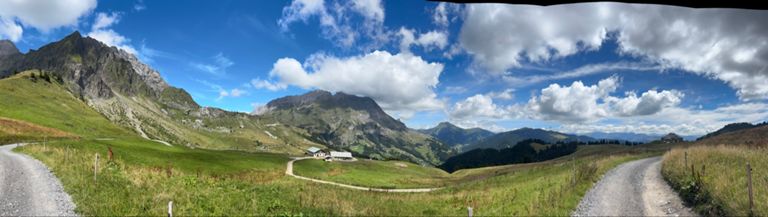
Running Route
Hard
12.13 km
742 m
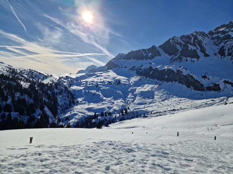
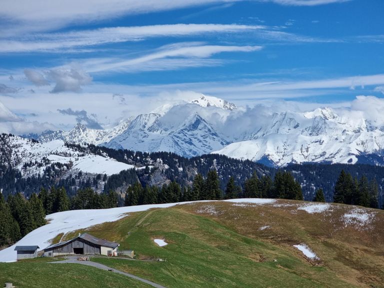
At 1487m, the Col des Aravis is a mythical mountain pass in the French Alps linking the
departments of Haute-Savoie and Savoie as well as the two ski resorts of La Clusaz and La
Giettaz, the latter from where this epic trail route departs.
A hive of winter sports activity, come summer the pass is synonymous with cyclists and
self-inflicted suffering of the highest calibre (it has been used 41 times in the Tour de France,
most recently in 2020). For those less inclined to don full lycra however, the trail running
here is some of the finest in Europe, encompassing pine forests, quaint mountain huts,
pristine meadows where the sound of cow-bells clangs across the valleys and, it’s highest
reaches, snow-line scrambling.
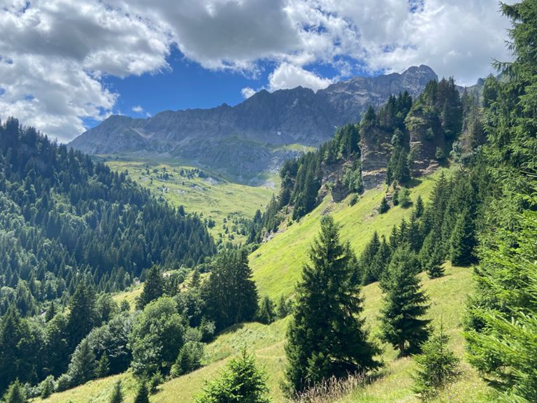
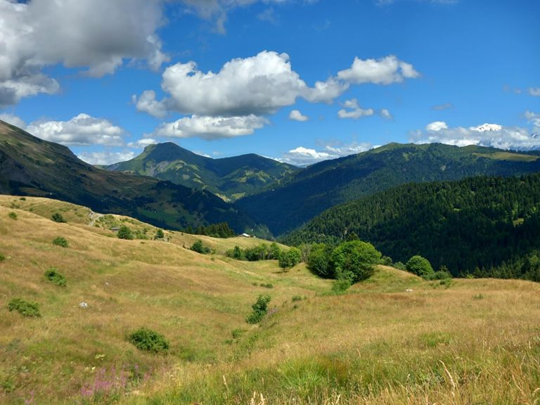
At 10.5 km with an Elevation gain of 632m, this route is the perfect introduction to Alpine trail
running, with equal measure lung-busting climbs to giddy switchback descents. With the
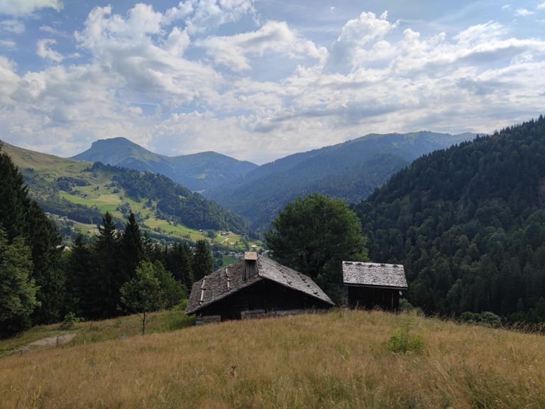
peak of Étale and the Aravis range towering above you pass the Plan Rebord restaurant
where, from June to the end of September this picture perfect Alpine chalet offers the weary
runner a welcome break before continuing with the loop. If you have the time for a gourmet
break, in an idyllic setting complete with magnificent view of Mont Blanc then this is where to
rest. Depending on which way you run, the route takes in forested valleys and a (potentially
muddy) crossing of the Ruisseau de Foiroux, which can be prone to thunder down stream
with meltwater in Spring/Summer.
Return to “La Giett” as the locals refer to it for some well earned Raclette or Tartiflette as a
cheesy reward.
departments of Haute-Savoie and Savoie as well as the two ski resorts of La Clusaz and La
Giettaz, the latter from where this epic trail route departs.
A hive of winter sports activity, come summer the pass is synonymous with cyclists and
self-inflicted suffering of the highest calibre (it has been used 41 times in the Tour de France,
most recently in 2020). For those less inclined to don full lycra however, the trail running
here is some of the finest in Europe, encompassing pine forests, quaint mountain huts,
pristine meadows where the sound of cow-bells clangs across the valleys and, it’s highest
reaches, snow-line scrambling.
At 10.5 km with an Elevation gain of 632m, this route is the perfect introduction to Alpine trail
running, with equal measure lung-busting climbs to giddy switchback descents. With the
peak of Étale and the Aravis range towering above you pass the Plan Rebord restaurant
where, from June to the end of September this picture perfect Alpine chalet offers the weary
runner a welcome break before continuing with the loop. If you have the time for a gourmet
break, in an idyllic setting complete with magnificent view of Mont Blanc then this is where to
rest. Depending on which way you run, the route takes in forested valleys and a (potentially
muddy) crossing of the Ruisseau de Foiroux, which can be prone to thunder down stream
with meltwater in Spring/Summer.
Return to “La Giett” as the locals refer to it for some well earned Raclette or Tartiflette as a
cheesy reward.
Route and Elevation
Segments
| Name | Distance | Elev. Diff. | Avg. Grade |
|---|---|---|---|
| Montée Giettaz-route de la soif | 2.52 km | 389 m | 15.3% |
| Aravis climb | 0.44 km | 88 m | 19.8% |
| D909 Climb | 0.83 km | 104 m | 12.4% |