


+ 103
Batterman Out and Back w/Rocky Reach
Cycling Route
Details
43.09 mi
2,357 ft
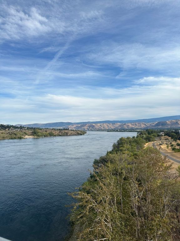
Route and Elevation
Segments
| Name | Distance | Elev. Diff. | Avg. Grade |
|---|---|---|---|
| Wenatchee Valley Sports Council | 0.18 mi | 3 ft | 0.2% |
| Walk Up (2.0) | 0.18 mi | 33 ft | 3.3% |
| up against the wall | 0.50 mi | 62 ft | 1.8% |
| Switchback sketchy | 0.19 mi | 20 ft | 2.0% |
| 328 | 1.07 mi | -36 ft | -0.2% |
| 8th street repeat | 1.06 mi | 217 ft | 3.8% |
| 8th st sprint | 0.31 mi | 56 ft | 3.4% |
| th St Se Climb | 1.63 mi | 344 ft | 4.0% |
| Upper 8th | 1.87 mi | 331 ft | 3.4% |
| 10th Street Sprint | 0.98 mi | -46 ft | -0.3% |
| South Van Well St. | 0.52 mi | 161 ft | 5.8% |
| Bianchi winery sprint. | 0.19 mi | 30 ft | 3.1% |
| Batterman part 2 | 1.57 mi | 420 ft | 5.1% |
| South Van Well Descent | 0.67 mi | -187 ft | -5.2% |
| Pangborn Loop 10th st | 0.96 mi | -56 ft | -0.2% |
| Ute to Eller | 4.19 mi | -413 ft | -1.4% |
| Pangborn water tower HC | 0.18 mi | 59 ft | 6.1% |
| Final Exam | 1.02 mi | 33 ft | 0.2% |
| Down against the wall | 0.48 mi | -56 ft | -1.5% |
| Hobo springs High speed | 0.30 mi | 46 ft | 0.2% |
| Bum Dodger | 0.98 mi | -52 ft | -0.8% |
| 19th to odebashn | 2.73 mi | 75 ft | 0.1% |
| Gravel H!ll Sprint | 0.30 mi | 20 ft | 1.3% |
| Troll Toll | 0.19 mi | -13 ft | -1.3% |
| Out to Lincoln Rock | 5.11 mi | 125 ft | 0.4% |
| Odabashian to Guard Shack | 4.38 mi | 95 ft | 0.4% |
| North End Bridge to Lincoln Rock State Park | 4.95 mi | 121 ft | 0.4% |
| Danger DAM! | 0.43 mi | 72 ft | 2.6% |
| Pushin up Daisies | 0.42 mi | 43 ft | 1.0% |
| Hydro POWER | 2.58 mi | -121 ft | -0.8% |
| Back from Lincoln Rock | 5.12 mi | -125 ft | -0.3% |
| Lincoln Rock to Hwy 2 Bridge | 4.18 mi | -85 ft | -0.4% |
| Odabashian bridge W to Euclid | 0.67 mi | 46 ft | 0.9% |
| Loop Trail Bridge North Op | 0.42 mi | 49 ft | 0.4% |
| Techno gogo | 0.21 mi | -3 ft | -0.1% |
| Hawley Crawley | 0.55 mi | 30 ft | 1.0% |
| Diamond club | 0.36 mi | -10 ft | -0.0% |
| Lowe's low down | 0.62 mi | -16 ft | -0.5% |