Atividades
Principais desportos
Corrida
Ciclismo
Passeio
Caminhada
Corrida
Ciclismo
Funcionalidades
Mapas
Desafios
Assinatura
Iniciar sessão
Aderir gratuitamente
Aderir
Página principal
Atividades
Corrida
Ciclismo
Passeio
Caminhada
Funcionalidades
Mapas
Desafios
Assinatura
Suporte
Aderir
Iniciar sessão
Obtenha a aplicação
+ 139
AV A Ride 9/10/23
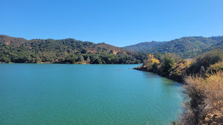
Rota de ciclismo
Guardar
Partilhar
Detalhes
63,79 milhas
5 773 ft
Criado por
Andrew Ernst
7 de setembro de 2023
·
Público
Rota e elevação
Segmentos
Nome
Distância
Dif. Elevação
Inclinação Média
Foothill - Page Mill to Hillview
0,55 milhas
-56 ft
-1,4%
Dive bomb
3,25 milhas
112 ft
0,3%
Foohill: Page Mill to Arastradero
1,13 milhas
-36 ft
-0,3%
Foothill, Arastradero to El Monte
2,33 milhas
128 ft
1,0%
Under the bridge (South)
0,17 milhas
26 ft
1,8%
Homestead to Montebello Grinder
3,49 milhas
289 ft
1,5%
Foothill - Offramp Light to Cristo Rey
0,29 milhas
75 ft
4,8%
Stevens Creek to County Park
1,22 milhas
112 ft
1,7%
Steven's Canyon Hill Sprint
0,13 milhas
39 ft
5,5%
Stevens Canyon - McClellan to Montebello
1,60 milhas
131 ft
1,4%
Stevens Canyon, Redwood Gulch & Hwy 9 to Skyline
8,99 milhas
2 178 ft
4,6%
Stevens Canyon to Mt Eden Rd Stop Sign
2,85 milhas
128 ft
0,7%
stevens creek res - mt eden stop sign
1,84 milhas
52 ft
0,3%
Watch for close overtakes by bad drivers
0,18 milhas
20 ft
2,1%
Use it or Lose It! Push!
0,30 milhas
-43 ft
-0,0%
Stevens Canyon Rd (Cal-Fire to Mt. Eden)
0,65 milhas
43 ft
0,1%
RWG uphill start-end
3,25 milhas
945 ft
5,3%
Stevens Canyon-Base RWG
1,56 milhas
207 ft
2,4%
Lower Redwood Gulch Rd
1,03 milhas
-2536 ft
-0,0%
Redwood Gulch Climb (no DH at end)
1,19 milhas
682 ft
10,8%
Redwood Gulch: the wall
0,43 milhas
259 ft
11,2%
Easiest part of RWG
0,28 milhas
125 ft
8,4%
RWG & Highway 9
4,40 milhas
1 867 ft
8,0%
RWG: When Wall 1 hits you
0,18 milhas
151 ft
15,9%
Try not to fall off backwards
0,71 milhas
410 ft
10,6%
RWG: Second Half
0,70 milhas
381 ft
10,2%
Hwy 9 Climb - Redwood Gulch to Skyline
3,00 milhas
1 122 ft
7,0%
Big Basin Way Climb
0,73 milhas
276 ft
6,3%
Highway 9 - mile 0.51 to top
0,56 milhas
259 ft
8,7%
sprint to the top of 9
0,06 milhas
33 ft
8,5%
Skyline from Highway 9 to Page Mill
6,31 milhas
-617 ft
-1,2%
Hit 50 mph
0,92 milhas
-279 ft
-5,7%
Skyline: Long Ridge OSP to Skyline
3,08 milhas
-282 ft
-0,4%
Skyline Bump at OLH
0,21 milhas
62 ft
5,5%
Skyline - climb from 84 towards Kings
1,85 milhas
630 ft
6,4%
Skyline rollers (Kings mtn to Purisma Cr)
2,32 milhas
-82 ft
-0,1%
Skyline Callbox Grave to 92
0,91 milhas
-259 ft
-5,3%
CA92: Upper Skyline to Lower Skyline
1,95 milhas
-571 ft
-5,4%
Skyline to Canada
0,58 milhas
79 ft
1,7%
hill to flat
0,46 milhas
62 ft
2,6%
Cañada Rd Sprint
0,54 milhas
72 ft
2,5%
Sand Hill Horse Park Climb
0,61 milhas
128 ft
4,0%
Short Sandhill Sprint
0,29 milhas
62 ft
4,1%
Horse Park Crest to Santa Cruz
2,22 milhas
-266 ft
-2,2%
Top of Sand Hill to Publisher's Hill
1,12 milhas
-121 ft
-1,5%
Bye bye Bugatti
0,50 milhas
-20 ft
-0,8%
The Real Addison Wesley Sprint
0,17 milhas
33 ft
3,3%
Sand Hill Downhill Sprint
1,00 milhas
-135 ft
-2,5%
Junipero Serra: Alpine to Campus
0,55 milhas
30 ft
0,3%
Junipero Serra-Fremont Jump
0,30 milhas
59 ft
3,6%