
+ 17
No Slack Friday! Marin Headlands 3.5M Weekly Community Trail Run
Running Route
Moderate
3.4 mi
811 ft
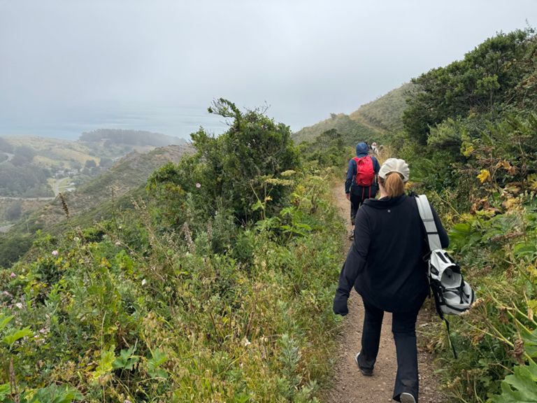
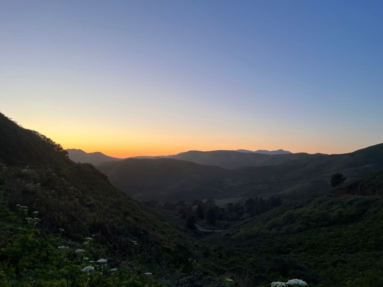
Join us every Friday at 6:30am in the Marin Headlands for a 3.5-mile trail run with breathtaking San Francisco sunrise views.
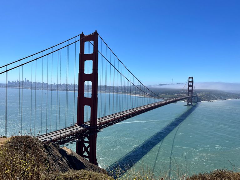
Hosted by Toby Silver (415-939-0450), this year round, rain or shine, all-paces welcome run starts at the Coastal Trail trailhead at Conzelman Parking Lot, just across the Golden Gate Bridge. No RSVP required.
Details:
* Meeting Time: Every Friday, 6:30am
* Meeting Point: Coastal Trail trailhead at Conzelman Parking Lot. You'll find the lot just below Conzelman road, adjacent to the bridge and bridge bike path. Google Maps: https://maps.app.goo.gl/UGm9tmZbNLVmZSwe7
* Run Start: Promptly at 6:35am
* Host: Toby
* Skill Level: All paces welcome, headlamps required fall/winter for the first 15-20 minutes.
The Route:
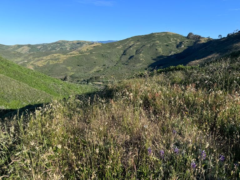
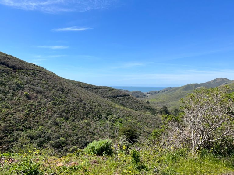
This short adventure takes you on a breathtaking loop with an added challenge: a climb to the top of Slacker Hill. Here are the detailed directions.
Directions:
- Begin your journey at the dirt trailhead next to the parking lot, heading up the Coastal Trail.
- Cross Conzelman Rd, and continue straight onto Coastal Trail, embarking on a 1-mile climb.
- At the T-Intersection, take a left onto Slacker Trail. You’ll continue climbing here, including some stairs.
- After .4 mile, make another left onto Slacker Ridge Trail. It looks like a fire road.
- Climb to the top, savor the panoramic views (Karl the Fog permitting), and then descend back to Slacker Ridge Trail, turning left.
- Cross McCullough Rd, and continue onto Julian Trail until you reach a parking lot.
- Take a left into the parking lot, heading toward the roundabout on Conzelman Rd.
- At the roundabout, use the pedestrian cross walk to cross Conzelman Rd, turn left, and descend the dirt trail that runs to the right of the road. - Enjoy the stunning views of the Golden Gate Bridge and the bay.
- Make a right turn on Coastal Trail, following it back to the Conzelman Parking Lot.
- Congratulations, you're done!
There are ample free parking spaces in the lot. No restrooms or water, however the H. Dana Bowers Rest Area & Vista Point parking lot on the east side of the bridge does. It's easily accessibly by foot via a short walk on a pathway that goes under the bridge.
Questions? Contact Toby @ 415-939-0450.
Individuals, groups, and local run clubs welcome. Look forward to seeing you!
Hosted by Toby Silver (415-939-0450), this year round, rain or shine, all-paces welcome run starts at the Coastal Trail trailhead at Conzelman Parking Lot, just across the Golden Gate Bridge. No RSVP required.
Details:
* Meeting Time: Every Friday, 6:30am
* Meeting Point: Coastal Trail trailhead at Conzelman Parking Lot. You'll find the lot just below Conzelman road, adjacent to the bridge and bridge bike path. Google Maps: https://maps.app.goo.gl/UGm9tmZbNLVmZSwe7
* Run Start: Promptly at 6:35am
* Host: Toby
* Skill Level: All paces welcome, headlamps required fall/winter for the first 15-20 minutes.
The Route:
This short adventure takes you on a breathtaking loop with an added challenge: a climb to the top of Slacker Hill. Here are the detailed directions.
Directions:
- Begin your journey at the dirt trailhead next to the parking lot, heading up the Coastal Trail.
- Cross Conzelman Rd, and continue straight onto Coastal Trail, embarking on a 1-mile climb.
- At the T-Intersection, take a left onto Slacker Trail. You’ll continue climbing here, including some stairs.
- After .4 mile, make another left onto Slacker Ridge Trail. It looks like a fire road.
- Climb to the top, savor the panoramic views (Karl the Fog permitting), and then descend back to Slacker Ridge Trail, turning left.
- Cross McCullough Rd, and continue onto Julian Trail until you reach a parking lot.
- Take a left into the parking lot, heading toward the roundabout on Conzelman Rd.
- At the roundabout, use the pedestrian cross walk to cross Conzelman Rd, turn left, and descend the dirt trail that runs to the right of the road. - Enjoy the stunning views of the Golden Gate Bridge and the bay.
- Make a right turn on Coastal Trail, following it back to the Conzelman Parking Lot.
- Congratulations, you're done!
There are ample free parking spaces in the lot. No restrooms or water, however the H. Dana Bowers Rest Area & Vista Point parking lot on the east side of the bridge does. It's easily accessibly by foot via a short walk on a pathway that goes under the bridge.
Questions? Contact Toby @ 415-939-0450.
Individuals, groups, and local run clubs welcome. Look forward to seeing you!
Route and Elevation
Segments
| Name | Distance | Elev. Diff. | Avg. Grade |
|---|---|---|---|
| Coastal Trail (GGB to Slacker Ridge) | 1.27 mi | 561 ft | 8.3% |
| GGB parking lot to top of slackers hill | 1.61 mi | 676 ft | 7.9% |
| Coastal Trail (GGB to SCA) | 1.09 mi | 433 ft | 7.4% |
| GGB to Coastal Trail Peak | 1.42 mi | 564 ft | 7.5% |
| Bridge to SCA Climb | 0.79 mi | 381 ft | 8.4% |
| Coastal Trail Parking Lot to Conzelman Rd. | 0.16 mi | 92 ft | 10.6% |
| Coastal to SCA | 0.87 mi | 338 ft | 7.0% |
| Coastal Trail (SCA to Slacker Hill) | 0.52 mi | 240 ft | 8.7% |
| SCA-Coastal Last (Last) Climb | 0.17 mi | 135 ft | 14.3% |
| From Coastal to Slacker | 0.51 mi | 246 ft | 8.9% |
| T-split left to top | 0.23 mi | 69 ft | 4.8% |
| Slacker Trail Climb | 0.21 mi | 167 ft | 14.8% |
| Conzelman Rd Climb | 0.23 mi | 174 ft | 13.5% |
| Slacker to Coastal Descent | 0.22 mi | -180 ft | -15.2% |
| Slacker Hill Descent | 0.19 mi | -161 ft | -15.7% |
| Hawk Hill - Descent (circle to crosswalk) | 1.02 mi | -249 ft | -4.6% |
| Conzelman Road Descent from the Circle | 1.03 mi | -233 ft | -4.3% |
| SCA Final Descent | 0.17 mi | -85 ft | -9.1% |
| SCA Final Descent (not hazardous) | 0.18 mi | -98 ft | -10.0% |