Aktivitäten
Top-Sportarten
Laufen
Radfahren
Spazieren gehen
Wandern
Laufen
Radfahren
Features
Karten
Herausforderungen
Mitgliedschaft
Anmelden
Kostenlos beitreten
Beitreten
Startseite
Aktivitäten
Laufen
Radfahren
Spazieren gehen
Wandern
Features
Karten
Herausforderungen
Mitgliedschaft
Support
Beitreten
Anmelden
Hol dir die App
+ 100
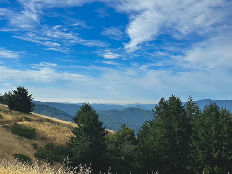
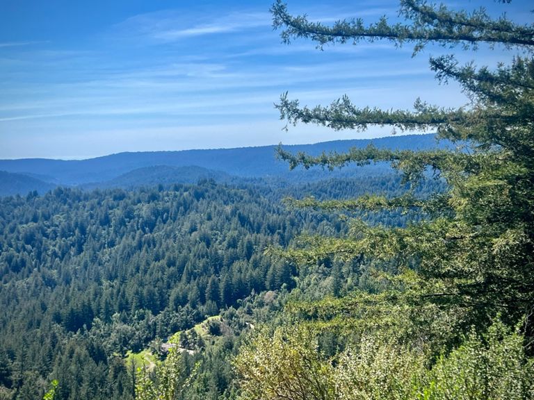
AVA Endurance: Big Basin
Radroute
Speichern
Teilen
Details
85,98 mi
8.739 ft
Erstellt von
Zack B
26. Januar 2024
·
Öffentlich
Route und Höhe
Segmente
Name
Distanz
Höhenunterschied
Steigung
Dish entrance to Page Mill
0,35 mi
-13 ft
-0,5 %
Old Page Mill Road
0,83 mi
69 ft
1,2 %
Page Mill - Arastradero to Moody
2,51 mi
679 ft
5,1 %
Page Mill - Arastradero to Altamont
1,91 mi
495 ft
4,9 %
Page Mill Road (Low-Key Hillclimbs)
8,30 mi
1.985 ft
4,5 %
The story of us. Page one
0,85 mi
92 ft
2,0 %
Page Mill - First Half
2,42 mi
837 ft
6,5 %
Page Mill - Alexis to Via Ventana
0,47 mi
197 ft
7,9 %
Page Mill: Altamont to FH 01 (500ft ascend)
1,32 mi
456 ft
6,5 %
partial page mill - palo alto town sign to that one plateau
2,47 mi
925 ft
7,0 %
Page Mill - Park Entrance to Moody
0,21 mi
112 ft
9,7 %
Page Mill - Moody to Montebello Open Space
4,39 mi
1.257 ft
5,4 %
Page Mill - Moody to Gate 3
1,49 mi
436 ft
5,5 %
Page Mill (SW): Moody → DeathSnake
0,95 mi
243 ft
4,4 %
Page Mill—Moody to drinking fountain
3,94 mi
1.175 ft
5,6 %
Page Mill—Naked Lady (Gate 3 to Gate 4)
0,63 mi
318 ft
9,3 %
Page Mill - Gate 4 to Skyline
3,61 mi
538 ft
2,3 %
Page Mill - Monte Bello Rd Climb
0,74 mi
282 ft
7,2 %
Page Mill - Last steep bump at Los Trancos
0,16 mi
92 ft
10,5 %
Page Mill Climb, Final Mile to Skyline
1,04 mi
-98 ft
-0,1 %
Page Mill to Skyline -- Final Sprint Climb
0,45 mi
75 ft
3,1 %
Skyline - Page Mill to Hwy 9
6,39 mi
568 ft
1,1 %
Skyline - Final SB climb N of Hwy 9
0,83 mi
279 ft
6,4 %
Full Bear Creek (9 to 35)
9,10 mi
1.660 ft
3,3 %
Bear Creek Road
3,10 mi
2.631 ft
0,0 %
sprint to the top of 9
0,06 mi
33 ft
8,5 %
Hwy 9 Descent - Skyline to Redwood Gulch
3,01 mi
-1.099 ft
-6,9 %
Hwy 9 Descent - Redwood Gulch Down to the Bridge
2,24 mi
-705 ft
-5,9 %
Hwy 9 Descent - Redwood Gulch to Sanborn
1,46 mi
-545 ft
-7,0 %
Hwy 9 Descent - Speed Trap
0,25 mi
-85 ft
-6,5 %
Pierce Rd Climb - Hwy 9 to Winery
0,36 mi
135 ft
7,0 %
Pierce DH - Winery to Mt. Eden
0,62 mi
-279 ft
-8,4 %
Mt Eden Back Side - Pierce to the Top
1,56 mi
266 ft
2,9 %
Pierce to Montebello
3,61 mi
-289 ft
-0,1 %
Mt Eden - East Side - the steep bit
0,41 mi
213 ft
9,7 %
Mt Eden - East Side - the really steep bit
0,13 mi
92 ft
12,9 %
Mt Eden - West side descent
0,69 mi
-246 ft
-6,6 %
Mt Eden west descent to 280
5,27 mi
-541 ft
-1,9 %
Stevens Canyon Rd - Canyon Picnic Parking Lot to Reservoir Parking Lot
1,81 mi
-43 ft
-0,2 %
Northern Steven's Canyon TT (short version)
2,96 mi
-141 ft
-0,8 %
Sprint from Steven's Canyon - Montebello to McClellan
1,73 mi
-138 ft
-1,4 %
Stevens Creek Dam to Foothill Bump
2,43 mi
-197 ft
-1,4 %
Stevens Canyon Sprint from past parking lot to top of hill
0,82 mi
-85 ft
-1,8 %
Thursday Night Sprint
0,34 mi
-16 ft
-0,6 %
Foothill: Stevens Creek to Cristo Rey Dr. Sprint.
0,60 mi
-36 ft
-0,8 %
Foothill Stevens Creek to Homestead
1,07 mi
-115 ft
-2,0 %
PV Sprint for coffee
0,30 mi
-30 ft
-1,4 %
Foothill - Arastradero to Page Mill
1,28 mi
49 ft
0,4 %
Foothill - Arastradero to Hillview
0,61 mi
16 ft
0,1 %
Foothill - Page Mill to Hillview
0,55 mi
-56 ft
-1,4 %