Night Owl 20 Mile Route V8 7.18.24
Cycling Route
Details
19.73 mi
313 ft
Leaving City Hall, Turn LEFT on Woodstock St.
Woodstock St. to Williams St. Turn RIGHT
Williams St. across CL Ave and follow to Ester St.,
Turn LEFT on Ester and then turn RIGHT on Prairie Path
Stay on Prairie Path to Berkshire Dr.,
Turn RIGHT on Berkshire Dr. to Coventry Ln.
Turn LEFT on Coventry
Coventry to Dartmoor Dr., Turn RIGHT on Dartmoor Dr.
Dartmoor Dr. to the light at McHenry Ave. Cross McHenry Ave and continue straight on Dartmoor to Concord Dr. Turn LEFT on Windsor then LEFT on Concord
Follow Concord to Amberwood and turn LEFT on Amberwood, join the path on left side and travel through Sam John’s Park. to Westport Ridge,
RIGHT At Westport Ridge, follow Westport Ridge cross Ackman at the flashing light crosswalk then stay on Westport Ridge to Alexandra Blvd.
Turn LEFT on Alexandra Blvd. To Skyridge Dr.
Turn RIGHT on Skyridge Dr.
Skyridge Dr. will turn into Carlemont. Stay on Carlemont to Village Rd.
At Village Rd. Turn RIGHT
At Golf Course Rd. Turn RIGHT
Follow Golf Course Rd. to Willow Tree Dr., Turn LEFT on Willow Tree Dr.
The REST STOP will be off the WOODSCREEK PARK parking lot on Willow Tree Dr. Bathrooms will be open. Light snacks and water available. Bike assistance through WheelWerks.
To Return to the 20 MILE ROUTE, when leaving WOODSCREEK PARK:
Go RIGHT out of the parking lot and follow Willow Tree Dr. to Blue Heron Dr.
Turn RIGHT on Blue Heron.
Turn RIGHT on Woodscreek Cir to Alexandra.
At Alexandra Blvd. Turn RIGHT
Alexandra Blvd to Driftwood Lane, Turn LEFT
Follow Driftwood Lane to Village Rd., Turn LEFT
Village Rd., to Golf Course Rd., Turn LEFT
Golf Course Rd. To Barlina, Turn LEFT on Barlina
Barlina to Blue Mound Dr., Turn RIGHT on Blue Mound
Blue Mound to Wedgewood Dr.,
Turn LEFT on Wedgewood
Wedgwood Dr. to Country Club Rd., Turn LEFT on Country Club
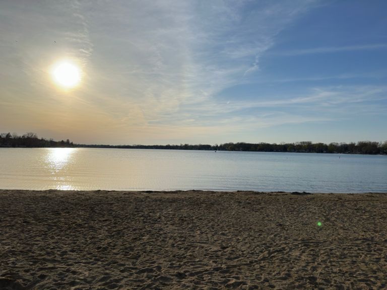
Country Club Rd. to Lake Ave/Lake Shore Dr., Turn RIGHT
Lake Shore Dr go straight onto Dole Ave at main beach parking entrance
Follow Dole Ave across Rt. 14 to Oak St., Turn LEFT
Oak St. to Woodstock St., Turn RIGHT on Woodstock
Woodstock St., to Grant St., Turn LEFT on Grant
Follow Grant across the train tracks to Gates St., Turn LEFT on Gates. (watch for 2 way bike traffic on path from here on)
Proceed on Gates St. to Walkup, join the bike path along East side ofWalkup Ave. Cross 176 and re-join the bike path (remain on East side of Walkup). Proceed on path to end of Veterans Acres
Just past Veterans Acres, Cross Walkup Ave at the flashing crosswalk, turning LEFT onto PATH RidgeField Trace.
Ridgefield Trace to N Larium Ln Turn RIGHT on Larium
Larium to Midlane, at Midlane Turn LEFT.
Follow Midlane Dr. to Spring ridge Dr. Turn RIGHT on Spring Ridge then LEFT on Crystal Ridge Dr. follow Crystal Ridge to Carmella St. Turn LEFT. then at Mira St, Turn RIGHT on Mira.
Proceed on Mira to Talismon Dr. Turn LEFT
RIGHT onto Larium
RIGHT back on to Ridgefield Trace Path.
Follow Ridgefield Trace back to Walkup, cross at flashing light crosswalk and proceed on path along Walkup across 176
Proceed on path along Walkup to Gates St. Turn LEFT. Gates to Grant St and Turn RIGHT.
Grant to Woodstock St. and turn RIGHT.
Return to City Hall, located at the corner of N. Walkup Ave and Woodstock St.
Woodstock St. to Williams St. Turn RIGHT
Williams St. across CL Ave and follow to Ester St.,
Turn LEFT on Ester and then turn RIGHT on Prairie Path
Stay on Prairie Path to Berkshire Dr.,
Turn RIGHT on Berkshire Dr. to Coventry Ln.
Turn LEFT on Coventry
Coventry to Dartmoor Dr., Turn RIGHT on Dartmoor Dr.
Dartmoor Dr. to the light at McHenry Ave. Cross McHenry Ave and continue straight on Dartmoor to Concord Dr. Turn LEFT on Windsor then LEFT on Concord
Follow Concord to Amberwood and turn LEFT on Amberwood, join the path on left side and travel through Sam John’s Park. to Westport Ridge,
RIGHT At Westport Ridge, follow Westport Ridge cross Ackman at the flashing light crosswalk then stay on Westport Ridge to Alexandra Blvd.
Turn LEFT on Alexandra Blvd. To Skyridge Dr.
Turn RIGHT on Skyridge Dr.
Skyridge Dr. will turn into Carlemont. Stay on Carlemont to Village Rd.
At Village Rd. Turn RIGHT
At Golf Course Rd. Turn RIGHT
Follow Golf Course Rd. to Willow Tree Dr., Turn LEFT on Willow Tree Dr.
The REST STOP will be off the WOODSCREEK PARK parking lot on Willow Tree Dr. Bathrooms will be open. Light snacks and water available. Bike assistance through WheelWerks.
To Return to the 20 MILE ROUTE, when leaving WOODSCREEK PARK:
Go RIGHT out of the parking lot and follow Willow Tree Dr. to Blue Heron Dr.
Turn RIGHT on Blue Heron.
Turn RIGHT on Woodscreek Cir to Alexandra.
At Alexandra Blvd. Turn RIGHT
Alexandra Blvd to Driftwood Lane, Turn LEFT
Follow Driftwood Lane to Village Rd., Turn LEFT
Village Rd., to Golf Course Rd., Turn LEFT
Golf Course Rd. To Barlina, Turn LEFT on Barlina
Barlina to Blue Mound Dr., Turn RIGHT on Blue Mound
Blue Mound to Wedgewood Dr.,
Turn LEFT on Wedgewood
Wedgwood Dr. to Country Club Rd., Turn LEFT on Country Club
Country Club Rd. to Lake Ave/Lake Shore Dr., Turn RIGHT
Lake Shore Dr go straight onto Dole Ave at main beach parking entrance
Follow Dole Ave across Rt. 14 to Oak St., Turn LEFT
Oak St. to Woodstock St., Turn RIGHT on Woodstock
Woodstock St., to Grant St., Turn LEFT on Grant
Follow Grant across the train tracks to Gates St., Turn LEFT on Gates. (watch for 2 way bike traffic on path from here on)
Proceed on Gates St. to Walkup, join the bike path along East side ofWalkup Ave. Cross 176 and re-join the bike path (remain on East side of Walkup). Proceed on path to end of Veterans Acres
Just past Veterans Acres, Cross Walkup Ave at the flashing crosswalk, turning LEFT onto PATH RidgeField Trace.
Ridgefield Trace to N Larium Ln Turn RIGHT on Larium
Larium to Midlane, at Midlane Turn LEFT.
Follow Midlane Dr. to Spring ridge Dr. Turn RIGHT on Spring Ridge then LEFT on Crystal Ridge Dr. follow Crystal Ridge to Carmella St. Turn LEFT. then at Mira St, Turn RIGHT on Mira.
Proceed on Mira to Talismon Dr. Turn LEFT
RIGHT onto Larium
RIGHT back on to Ridgefield Trace Path.
Follow Ridgefield Trace back to Walkup, cross at flashing light crosswalk and proceed on path along Walkup across 176
Proceed on path along Walkup to Gates St. Turn LEFT. Gates to Grant St and Turn RIGHT.
Grant to Woodstock St. and turn RIGHT.
Return to City Hall, located at the corner of N. Walkup Ave and Woodstock St.
Route and Elevation
Segments
| Name | Distance | Elev. Diff. | Avg. Grade |
|---|---|---|---|
| Cut Through | 0.58 mi | -33 ft | -0.6% |
| village hill | 0.60 mi | 52 ft | 1.7% |
| Country Club Fairway | 0.92 mi | -13 ft | -0.2% |
| Veteran's View | 0.47 mi | -20 ft | -0.4% |