


+ 110
Paris Mountain Half Marathon
Trail Running Route
Details
13.4 mi
2,054 ft
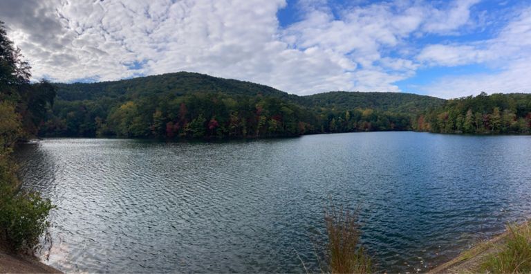
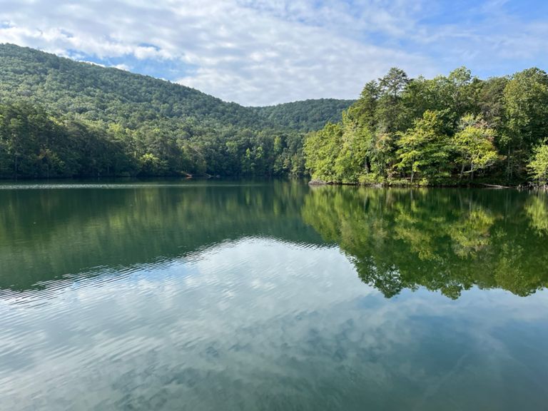
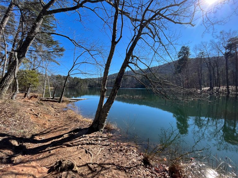
Discover the ultimate trail running adventure at the Paris Mountain Half Marathon, where rugged terrain and breathtaking views come together for an unforgettable experience. Nestled in the heart of Paris Mountain State Park, this challenging trail race takes you on a journey through some of the most scenic landscapes in South Carolina. With a demanding elevation gain of 2,500 feet, you'll traverse switchbacks, circle pristine lakes, and summit the park's highest peaks. This race is perfect for trail running enthusiasts seeking to push their limits and immerse themselves in the natural beauty of Paris Mountain.
The Paris Mountain Half Marathon course is designed to highlight the park's diverse and stunning terrain. As you navigate the trails, you'll encounter lush forests, tranquil lakes, and the exhilarating switchbacks that wind their way up to the mountain's summit. Each section of the trail offers unique challenges and rewards, from steep climbs that test your endurance to serene lakeside paths that provide a moment of tranquility. The breathtaking vistas from the summit are a fitting reward for your efforts, offering panoramic views that make every step worthwhile.
The Paris Mountain Half Marathon course is designed to highlight the park's diverse and stunning terrain. As you navigate the trails, you'll encounter lush forests, tranquil lakes, and the exhilarating switchbacks that wind their way up to the mountain's summit. Each section of the trail offers unique challenges and rewards, from steep climbs that test your endurance to serene lakeside paths that provide a moment of tranquility. The breathtaking vistas from the summit are a fitting reward for your efforts, offering panoramic views that make every step worthwhile.
Route and Elevation
Segments
| Name | Distance | Elev. Diff. | Avg. Grade |
|---|---|---|---|
| Turtle Trail to Shelter #5 | 0.83 mi | 89 ft | 1.0% |
| Sassafras Loop CounterClockwise | 2.17 mi | -282 ft | -0.3% |
| Paris Mountain - Sulphur spring to Laurel | 1.32 mi | 522 ft | 7.5% |
| State Park Road Climb | 0.62 mi | 148 ft | 4.5% |
| Sulphur Springs Grinder | 0.87 mi | 459 ft | 9.5% |
| Laurel Falls Way Climb | 0.72 mi | 390 ft | 10.3% |
| Firetower to NorthLake | 1.41 mi | -466 ft | -5.6% |
| Firetower Down to Lake | 1.13 mi | -443 ft | -7.3% |
| NorthLake to End of Dam | 0.64 mi | -39 ft | -0.3% |
| Kimberly Dr Climb | 0.63 mi | 233 ft | 6.6% |
| Brissey Ridge Climb | 0.84 mi | 358 ft | 8.0% |
| Paris Mountain State Park Climb | 0.51 mi | 312 ft | 11.5% |
| Paris Mountain State Park Climb | 0.30 mi | 190 ft | 11.8% |
| PMSP Downhill | 1.00 mi | -407 ft | -7.4% |
| Archery Lot to Shelter 5 | 0.66 mi | -138 ft | -3.4% |
| 7k Route, 2nd 2 miles | 2.03 mi | -210 ft | -1.4% |
| Shelter #5 to Turtle Trail | 0.83 mi | -92 ft | -1.2% |