

+ 194
Gorges de la Nesque et Ventoux: De Sault à Bédoin
Cycling Route
Details
92.64 km
1,976 m
Tour des Villes et Vallées du Ventoux"
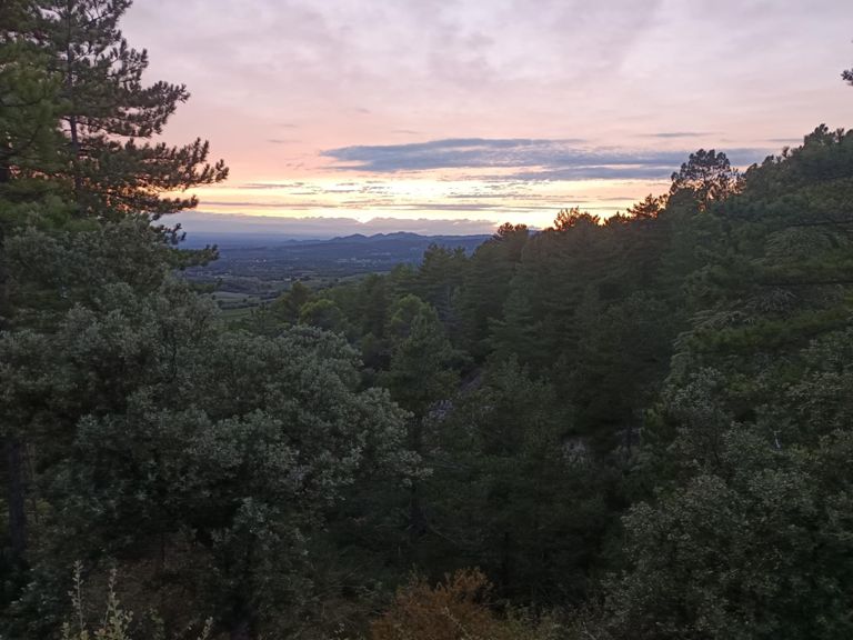
This unforgettable cycling tour takes you through some of the most beautiful villages of Provence and up to the summit of Mont Ventoux. Starting from Sault, the route winds through lavender fields, historic stone villages, and offers breathtaking views while allowing you to explore the cultural heritage of the region.
Starting Point: Sault
Sault, with a history dating back to Roman times, is a peaceful village surrounded by lavender fields. Since the Middle Ages, it has been known for agriculture and livestock. With its old stone houses and narrow streets, Sault captures the essence of a typical Provencal village and serves as the perfect starting point for this tour.
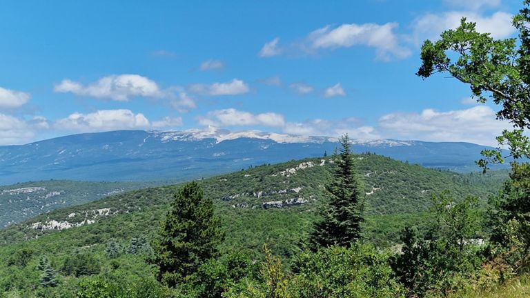
Saint Jean and Belvedere Saint Hubert
As you move towards Saint Jean, the village’s agricultural roots accompany you. The locals have long engaged in viticulture and olive farming, making Saint Jean one of the quietest and most tranquil villages in Provence. Upon reaching Belvedere Saint Hubert, you can take in breathtaking views while soaking in the historical atmosphere of the region. Here, you will find traces of pastoral life at the foot of Ventoux.
Methamis and Saint Estève
Methamis is known for its Roman roots and strategic importance throughout the Middle Ages. The village is filled with old stone structures and walls that testify to Provence’s rich history. As you continue towards Saint Estève, you begin to meet the challenging slopes of Ventoux. Saint Estève is known as the gateway to Ventoux's difficult climbs, with its famous historical bridges.
Mormoiron and Bédoin
Mormoiron is renowned for its historical churches and Roman ruins. The village’s old stone houses, historical fountains, and vineyards contribute to the cultural heritage of Provence. From here, the route leads to Bédoin. Bédoin is one of the most popular starting points for climbs up Mont Ventoux and a favorite stop for cyclists. Strategically important during the Middle Ages, today Bédoin is one of the liveliest villages around Ventoux.
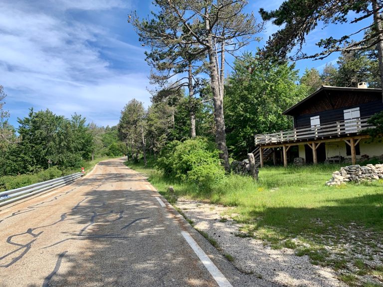
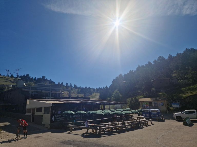
Towards the Summit: Chalet Reynard
As you climb from Bédoin to Chalet Reynard, it’s fascinating to know that this region has been a strategic passage throughout history. Even during Roman times, the harshness of Ventoux was seen as a formidable challenge. Chalet Reynard is a well-known rest point where cyclists stop to recover before continuing to the summit.
Return to Sault
After reaching the summit, the descent towards Sault offers a well-deserved reward after the grueling climb. The stunning landscapes of Provence accompany you on the way down, blending history and nature, providing both a physical and spiritual refreshment.
This unforgettable cycling tour takes you through some of the most beautiful villages of Provence and up to the summit of Mont Ventoux. Starting from Sault, the route winds through lavender fields, historic stone villages, and offers breathtaking views while allowing you to explore the cultural heritage of the region.
Starting Point: Sault
Sault, with a history dating back to Roman times, is a peaceful village surrounded by lavender fields. Since the Middle Ages, it has been known for agriculture and livestock. With its old stone houses and narrow streets, Sault captures the essence of a typical Provencal village and serves as the perfect starting point for this tour.
Saint Jean and Belvedere Saint Hubert
As you move towards Saint Jean, the village’s agricultural roots accompany you. The locals have long engaged in viticulture and olive farming, making Saint Jean one of the quietest and most tranquil villages in Provence. Upon reaching Belvedere Saint Hubert, you can take in breathtaking views while soaking in the historical atmosphere of the region. Here, you will find traces of pastoral life at the foot of Ventoux.
Methamis and Saint Estève
Methamis is known for its Roman roots and strategic importance throughout the Middle Ages. The village is filled with old stone structures and walls that testify to Provence’s rich history. As you continue towards Saint Estève, you begin to meet the challenging slopes of Ventoux. Saint Estève is known as the gateway to Ventoux's difficult climbs, with its famous historical bridges.
Mormoiron and Bédoin
Mormoiron is renowned for its historical churches and Roman ruins. The village’s old stone houses, historical fountains, and vineyards contribute to the cultural heritage of Provence. From here, the route leads to Bédoin. Bédoin is one of the most popular starting points for climbs up Mont Ventoux and a favorite stop for cyclists. Strategically important during the Middle Ages, today Bédoin is one of the liveliest villages around Ventoux.
Towards the Summit: Chalet Reynard
As you climb from Bédoin to Chalet Reynard, it’s fascinating to know that this region has been a strategic passage throughout history. Even during Roman times, the harshness of Ventoux was seen as a formidable challenge. Chalet Reynard is a well-known rest point where cyclists stop to recover before continuing to the summit.
Return to Sault
After reaching the summit, the descent towards Sault offers a well-deserved reward after the grueling climb. The stunning landscapes of Provence accompany you on the way down, blending history and nature, providing both a physical and spiritual refreshment.