

+ 194
Waterfall Return - BikeRentalcc
Cycling Route
Details
113.44 km
1,587 m
The Waterfall Return is a true South Coast endurance classic—linking the stunning Illawarra coastline with the rolling climbs and lush bushland of the Royal National Park. At just over 113 km and almost 1,600 m of elevation, this route delivers the perfect mix of long coastal stretches, sustained climbs, and high-speed descents.
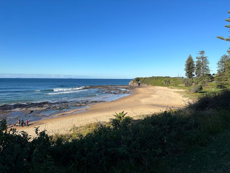
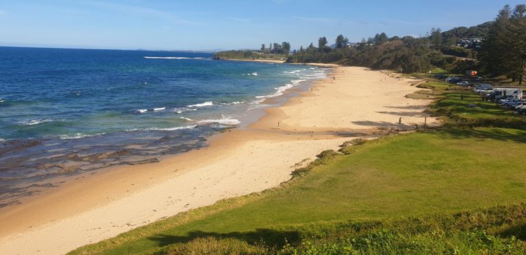
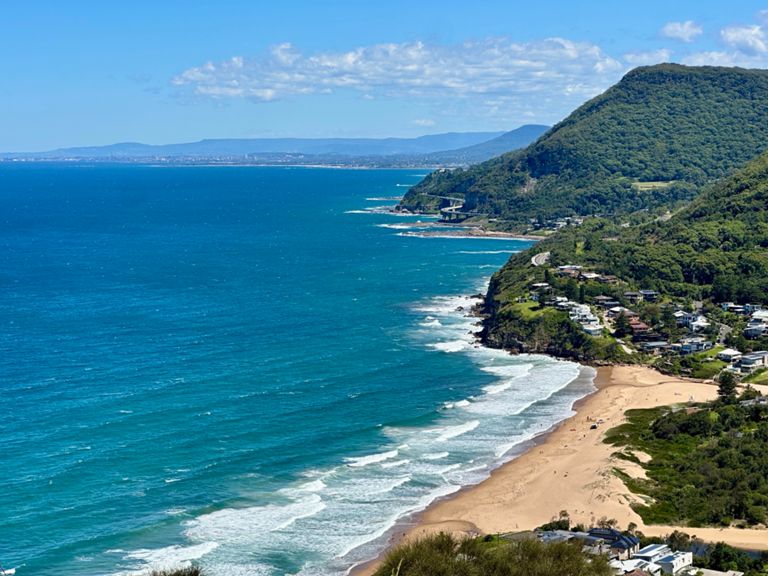
Rolling out from Wollongong, you head north along the coast, passing a string of iconic local landmarks including the Sea Cliff Bridge—a must-ride highlight offering panoramic ocean views. From there, the route winds through coastal villages before the gradient ramps up on the Bald Hill Climb, rewarding you with breathtaking views from the lookout across the escarpment and Pacific Ocean.
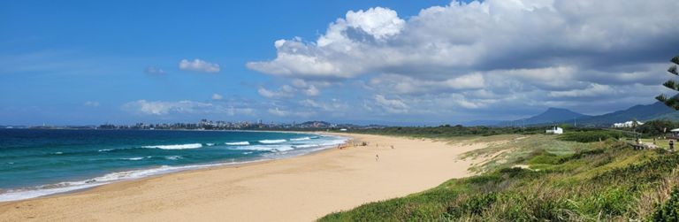
The journey continues into the Royal National Park, where shaded, winding roads take you deep into the forest. The climb up to Waterfall is steady and scenic, with native bushland on all sides and the occasional glimpse back toward the coast. After a short breather at the top, you’ll turn and retrace your route, enjoying the fast, flowing descent through the park.
The return leg offers another chance to savour the Sea Cliff Bridge before rolling back into Wollongong with the ocean breeze at your side. This ride is perfect for experienced cyclists looking for a satisfying endurance day that blends scenery, challenge, and the best of coastal and bushland riding.
Rolling out from Wollongong, you head north along the coast, passing a string of iconic local landmarks including the Sea Cliff Bridge—a must-ride highlight offering panoramic ocean views. From there, the route winds through coastal villages before the gradient ramps up on the Bald Hill Climb, rewarding you with breathtaking views from the lookout across the escarpment and Pacific Ocean.
The journey continues into the Royal National Park, where shaded, winding roads take you deep into the forest. The climb up to Waterfall is steady and scenic, with native bushland on all sides and the occasional glimpse back toward the coast. After a short breather at the top, you’ll turn and retrace your route, enjoying the fast, flowing descent through the park.
The return leg offers another chance to savour the Sea Cliff Bridge before rolling back into Wollongong with the ocean breeze at your side. This ride is perfect for experienced cyclists looking for a satisfying endurance day that blends scenery, challenge, and the best of coastal and bushland riding.