| Scarrots To Joan's | 0.13 mi | 3 ft | 0.7% |
| Hillstown to carr lane | 0.80 mi | 26 ft | 0.4% |
| Palterton to Suttons Scarsdale | 2.42 mi | -338 ft | -1.0% |
| up a bit | 2.11 mi | 279 ft | 2.4% |
| Palterton Lane Climb | 1.11 mi | 217 ft | 3.7% |
| Heath to Temple Normanton | 1.08 mi | -138 ft | -1.3% |
| Mansfield Road Descent | 0.55 mi | -108 ft | -3.8% |
| Mansfield road pond to junction | 0.46 mi | 72 ft | 3.0% |
| FINAL SPRINT HOME | 0.22 mi | 33 ft | 2.8% |
| B6039 - keep them turning | 0.69 mi | 36 ft | 0.6% |
| Holmewood to Clay Cross, Derbyshire's most beautiful places | 2.74 mi | -148 ft | -0.1% |
| Down Highfields | 0.49 mi | -43 ft | -1.5% |
| Williamthorpe Rd down to fuel station | 0.74 mi | -98 ft | -2.5% |
| top to bottom | 1.63 mi | -180 ft | -2.0% |
| 5 pits crossroads to York. | 0.27 mi | -20 ft | -1.3% |
| Down and up | 0.48 mi | -59 ft | -0.6% |
| church to church | 1.18 mi | 131 ft | 1.0% |
| Church Hill Blast | 0.22 mi | -36 ft | -2.1% |
| bywater pipes drag | 0.60 mi | 89 ft | 1.9% |
| Top of Market St | 0.40 mi | 39 ft | 1.8% |
| Camel's back | 0.80 mi | -59 ft | -1.4% |
| Handley Hill | 0.53 mi | 190 ft | 6.7% |
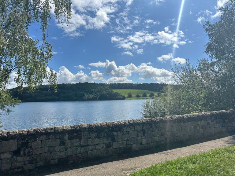
| Ogston reservoir | 1.12 mi | -72 ft | -0.3% |
| John Cena | 2.24 mi | 82 ft | 0.0% |
| Quarry lane steady climb | 0.27 mi | 49 ft | 2.5% |
| Past Oggy to the Church | 0.96 mi | 49 ft | 0.1% |
| Smooth as Butter | 0.93 mi | -69 ft | -0.7% |
| Butterfield lane kicker | 0.21 mi | 30 ft | 1.3% |
| Butterfield to Higham | 0.95 mi | 66 ft | 0.6% |
| Climb to Higham (Just the Climb) | 0.31 mi | 151 ft | 9.1% |
| Stonebroom high street down hill | 1.60 mi | -98 ft | -1.1% |
| Town end to stonebroom | 0.44 mi | -23 ft | -0.9% |
| Pilsley 'actual steepest bit' | 0.58 mi | 95 ft | 3.1% |
| Steep part of Pilsley | 0.85 mi | 138 ft | 3.0% |
| Pilsley school blast | 0.32 mi | 30 ft | 1.7% |
| Pilsley Primary School to Five Pits | 0.32 mi | 30 ft | 1.8% |
| deep lane to motorway bridge | 1.05 mi | -180 ft | -3.0% |
| Tibshelf Road to Hardwick Inn | 1.15 mi | -213 ft | -3.3% |
| Deep lane to the bottom | 1.18 mi | -69 ft | -1.0% |
| Stainsby to Rowthorne | 1.75 mi | 256 ft | 2.6% |
| Full Ault Hucknall climb | 0.81 mi | 246 ft | 5.6% |
| Alt hucknall climb to the end of the road | 1.52 mi | 266 ft | 3.3% |
| Up, up and up again! | 0.36 mi | 184 ft | 9.7% |
| hucknall ln sprint | 0.09 mi | -7 ft | -1.2% |
| Ault hucknall to dukes drive | 0.37 mi | -36 ft | -0.5% |
| Hair Bobble | 0.39 mi | 26 ft | 0.8% |
| Glapwell To Palterton Road | 1.19 mi | 23 ft | 0.1% |
| Glapwell to Bolsover | 1.92 mi | 26 ft | 0.0% |
| Losk Lane to Hills Town | 1.46 mi | -39 ft | -0.2% |
| A Steely Pleasant Dig | 0.54 mi | -16 ft | -0.3% |