


+ 194
Waterton Canyon
跑步路线
中等
12.48英里
354英尺
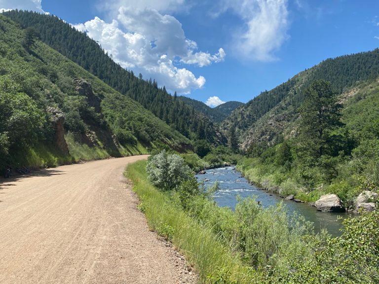
Runners head to Waterton Canyon to get a taste of spectacular mountain scenery without too much elevation change. Waterton Canyon is the eastern terminus of the famed Colorado Trail, which travels nearly 500 miles from Denver to Durango. The route through Waterton Canyon follows the gravel road that runs alongside the rumbling South Platte River and gradually slopes upwards for 6 miles to the Strontia Springs Dam. The wide gravel road is closed to traffic and attracts runners, cyclists, hikers, families, and anglers. The trail also features mile markers and restrooms at the top and bottom. The canyon is home to a herd of bighorn sheep that are often found grazing alongside the road. Visitors love to take pictures of the sheep as they wander in and out of the road. When you reach the dam at the top you’ll only have ascended a few hundred feet and you’ll have a nice gradual downhill for your return journey. From the dam, you can choose to extend this route onto the Colorado Trail if you are craving more mileage and some serious climbing.
创建者
Strava Athlete

路线和海拔
路段
| 名字 | 距离 | 海拔高度差 | 平均坡度 |
|---|---|---|---|
| Waterton Canyon 0-3 Miles | 3.04英里 | 108英尺 | 0.6% |
| Waterton Canyon 3-6 Miles | 2.97英里 | 187英尺 | 1.1% |
| Waterton Out of The Canyon | 6.00英里 | -289英尺 | -0.9% |
| mile 4 to start | 3.68英里 | -154英尺 | -0.6% |