

Mês passado


+ 2
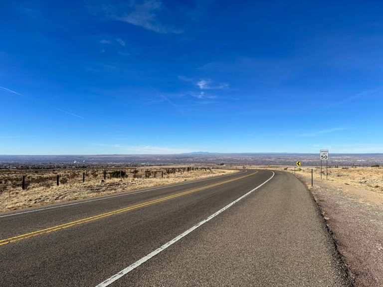
to El Vado
Rota de ciclismo
Detalhes
130,33 milhas
5 288 pés
Home to El Vado
Criado por
Jason Caldwell

Rota e elevação
Segmentos
| Nome | Distância | Dif. Elevação | Inclinação Média |
|---|---|---|---|
| Comanche Tramway to San Rafael | 2,69 milhas | 194 pés | 1,3% |
| Manitoba to Spain (Road) | 0,48 milhas | 20 pés | 0,7% |
| Manitoba to County Line | 3,59 milhas | 141 pés | 0,7% |
| Manitoba to County Line TT | 3,48 milhas | 125 pés | 0,7% |
| Spain to Academy (bike path) | 0,41 milhas | 20 pés | 0,8% |
| Spain to Tennyson | 3,09 milhas | 135 pés | 0,8% |
| Spain to Tennyson via Tramway | 3,07 milhas | 128 pés | 0,8% |
| Tramway- Academy to Tramway Lane | 2,50 milhas | 95 pés | 0,7% |
| Tramway - Academy to Tram & Tram | 2,60 milhas | 92 pés | 0,7% |
| San Rafael - Tramway Terrace | 0,32 milhas | 13 pés | 0,8% |
| San Rafael to Live Oak | 0,93 milhas | 16 pés | 0,2% |
| Cedar Hill to County Line | 0,43 milhas | 30 pés | 1,3% |
| Tramway to Roundabout | 6,41 milhas | -1106 pés | -3,3% |
| Decending county line to Hummingbird Rd | 4,05 milhas | -702 pés | -3,3% |
| Tram/Tram to Gas Station | 4,44 milhas | -778 pés | -3,3% |
| Tram/Tram to Traffic Circle | 6,37 milhas | -1024 pés | -3,0% |
| La Luz to Hummingbird Rd | 3,15 milhas | -620 pés | -3,7% |
| Tramway descent from La Luz to circle | 5,51 milhas | -1017 pés | -3,5% |
| La Luz to Gas Station NO LIGHTS! | 3,54 milhas | -715 pés | -3,8% |
| 333 decent to Hummingbird Rd. | 3,40 milhas | -728 pés | -4,0% |
| La Luz to I-25 | 3,72 milhas | -738 pés | -3,7% |
| Descent Roy Ave to Circle | 1,44 milhas | -167 pés | -2,2% |
| I-25 to New Bridge | 1,28 milhas | -148 pés | -2,2% |
| Bernalillo north roundabout to mm6 | 6,25 milhas | 39 pés | 0,1% |
| Roundabout to Hedges Oil | 3,33 milhas | 16 pés | 0,0% |
| 313 N to bernalillo | 6,37 milhas | 39 pés | 0,1% |
| North Berna TT | 5,91 milhas | 43 pés | 0,1% |
| First 3.5 | 3,43 milhas | 7 pés | 0,0% |
| 313 Circle N to Bernalillo | 6,27 milhas | 33 pés | 0,1% |
| 313 northbound | 6,64 milhas | 46 pés | 0,1% |
| NM 313 NB - the middle 5 miles | 5,02 milhas | 33 pés | 0,1% |
| Santa Ana QP Climb | 1,69 milhas | 118 pés | 1,2% |
| 550 to Unser | 4,57 milhas | 466 pés | 1,7% |
| 550 to Armory | 3,72 milhas | 486 pés | 2,5% |
| PDV to the Top | 3,04 milhas | 384 pés | 2,4% |
| 550-PdVtoNWLoop | 3,38 milhas | 381 pés | 2,0% |
| Big Chief Hustle NW | 7,97 milhas | 82 pés | 0,1% |
| Zia to State Road 4 | 5,56 milhas | 52 pés | 0,2% |
| U.S. 550 Climb | 1,38 milhas | 282 pés | 3,8% |