Strava
Móvil
Características
Suscribirse
Mapas
Historias
Suscribirse
Iniciar sesión
Última semana
Últimas dos semanas
Últimas dos semanas
Último mes
Último mes
+ 194
c2c ist centuary training
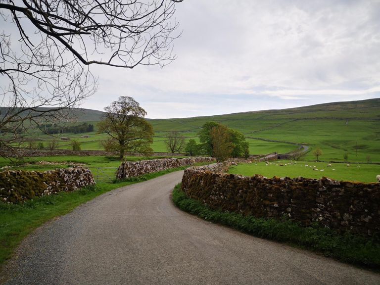
Ruta ciclística
Guardar
Compartir
Insertar
Copiar URL
Exportar en TCX
Exportar en GPX
Imprimir
Detalles
111.45 mi
9,078 ft
long & tough
Creada por
Steve G
13 de abril de 2015
·
Público
Ruta y desnivel
Segmentos
Nombre
Distancia
Diferencia de altitud
Pendiente media
Otley > Ilkley TT
5.98 mi
200 ft
0.1 %
power up the drag!
0.28 mi
79 ft
5.3 %
Throstle Nest Close climber
0.84 mi
105 ft
2.0 %
Weston Lane Hill Sprint
0.13 mi
69 ft
9.2 %
tank it
0.49 mi
-36 ft
-1.4 %
Iron Bridge to Bouncy Bridge
0.95 mi
20 ft
0.4 %
30mph-Ikley sign sprint
0.44 mi
-20 ft
0.0 %
Ilkley to Barden TT
8.30 mi
354 ft
0.7 %
Nesfield
3.61 mi
141 ft
0.6 %
GC corner to Nesfeild hill race
0.57 mi
112 ft
3.7 %
Nesfeild to A59 T junction
2.58 mi
-89 ft
-0.0 %
L turn from Beasmley on to A59 then to bolton bridge.
0.42 mi
-13 ft
-0.5 %
Bolton Abbey to Burnsall
6.00 mi
407 ft
0.3 %
BA Climb
0.86 mi
190 ft
4.1 %
The Scale short
0.11 mi
46 ft
7.7 %
The Scale Drag
2.15 mi
249 ft
2.2 %
Burnsall Down
0.83 mi
-249 ft
-5.1 %
Hill into Grassington
0.23 mi
92 ft
7.4 %
Kettlewell backroad
5.81 mi
141 ft
0.2 %
Kettlewell to Buckden
3.41 mi
92 ft
0.5 %
Kettlewell to Starbotton
1.72 mi
56 ft
0.6 %
Stainforth - Halton Gill Total Climb Accurate
3.04 mi
774 ft
4.8 %
Appletreewick
0.11 mi
39 ft
6.7 %
Archway sprint
0.35 mi
16 ft
0.3 %
Bolton Abbey Roundabout to turn off Beamsley Lane
0.36 mi
26 ft
1.5 %
The narwhal, or narwhale (Monodon monoceros), is a medium-sized toothed whale and possesses a large "tusk" from a protruding canine tooth. It lives year-round in the Arctic waters around Greenland, Canada, and Russia. It is one of two living species of wh
7.94 mi
174 ft
0.1 %
A59 to the triangle
2.07 mi
-79 ft
-0.4 %
Nesfield, from the corner
0.60 mi
105 ft
3.0 %
Nesfield
0.32 mi
79 ft
4.5 %
Nesfield Climb
0.36 mi
95 ft
4.4 %
Fish n Chipper - Ilkley Sign Sprint - Allez Allez Allez
0.19 mi
-10 ft
-0.1 %
O'Looney Way
0.21 mi
-3 ft
-0.3 %
Ilkley to Iron Bridge
1.33 mi
-20 ft
-0.2 %
ilkley to otley TT
5.98 mi
-197 ft
-0.1 %
2.5 Miles East
2.46 mi
52 ft
0.2 %
#BANTET
0.28 mi
-16 ft
-1.0 %
Iron Bridge to Cockpit Farm Tea Rooms
3.07 mi
177 ft
0.7 %
Safari Park
0.41 mi
39 ft
1.8 %
River Wharf to Askwith
0.79 mi
108 ft
2.6 %
up to Askwith
1.23 mi
151 ft
2.3 %
Hill sprint from the West Lane bridge
0.34 mi
66 ft
3.6 %
West lane hill sprint to Askwith
0.66 mi
66 ft
1.8 %
Otley Sprint!!!!
0.38 mi
36 ft
0.7 %
Top West Ln hill to Pub in askwith
0.53 mi
66 ft
2.3 %
West Lane Pull
0.13 mi
36 ft
5.2 %
Askwith to Otley
2.70 mi
-200 ft
-1.1 %
Askwith postbox to out of Askwith
0.32 mi
-20 ft
-1.3 %
Weston Woods Down
0.46 mi
-125 ft
-5.1 %
Weston lane desent-River Wharfe
1.31 mi
-79 ft
-1.0 %
weston lane corner extended hill sprint
0.16 mi
-30 ft
-3.3 %