Strava
Мобильное приложение
Функции
Оформить подписку
Карты
Истории
Зарегистрироваться
Войти
+ 194
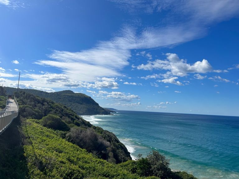
Wollongong Return
Велосипедный маршрут
Сохранить
Поделиться
Встроить
Копировать URL
Экспорт TCX
Экспорт GPX
Печать
Описание
169,05 км
2 334 м
Автор
Ian A
31 декабря 2019 г.
·
Открытый
Маршрут и высота
Участки
Имя
Дистанция
Разн. выс.
Средн. уклон
Todman Avenue to Airport
8,02 км
-30 м
-0,3 %
Airport Tunnel Gauntlet
1,75 км
-7 м
-0,1 %
Botany Bay - South
4,41 км
-5 м
-0,1 %
Rocky Rubble Road to Ramsgate
2,57 км
-6 м
-0,2 %
Hang a left
1,03 км
-4 м
-0,3 %
Captain Cook burn
0,37 км
14 м
3,6 %
Welcome to The Shire - Passport at the ready
1,00 км
-12 м
-1,0 %
Kingsway Climb
0,53 км
79 м
14,7 %
Kingsway to Princess Highway
3,67 км
59 м
1,3 %
Farnell-Old Bush Rd
3,05 км
63 м
2,1 %
lights to Loftus
0,84 км
23 м
2,7 %
Farnell Ave (RNP) to Yarrawarrah drag
1,76 км
22 м
1,3 %
Princes Highway Climb
0,54 км
96 м
17,5 %
The 3 rolling hills to waterfall
1,98 км
30 м
1,5 %
bill's hill
0,36 км
12 м
3,3 %
Waterfall Dash
1,50 км
-12 м
-0,6 %
Waterfall Drop into RNP
4,13 км
-202 м
-4,9 %
^^ Gong King KOM Climb
9,61 км
118 м
1,2 %
RNP Otford Climb
4,41 км
116 м
2,6 %
Otford Climb
2,63 км
93 м
3,5 %
Otford Lookout Climb
1,00 км
60 м
4,6 %
Sparrows half Bald Hill Descent
1,25 км
-127 м
-10,1 %
Seacliff Bridge - South
1,44 км
73 м
4,9 %
Clifton Hill Climb
0,31 км
26 м
8,2 %
Scarborough Pub to Thirroul Beach
6,35 км
-77 м
-1,2 %
Roller Coaster
2,04 км
-56 м
-2,8 %
A Mountain Rd Climb
0,61 км
26 м
2,6 %
Sandon Point to Nicholson Park
2,27 км
-12 м
-0,3 %
Farrell Road Hook
0,36 км
12 м
0,9 %
towradgi lights to pedestrian crossing
1,13 км
-7 м
-0,6 %
Elliotts Rd to Bridge Sth Bound
1,21 км
4 м
0,0 %
Diggies coffee box
0,41 км
1 м
0,3 %
Cliff Rd Climb South Bound
0,37 км
24 м
6,4 %
Virginia St to Dorrigo
6,60 км
18 м
0,1 %
IC TT Northbound
1,18 км
0 м
0,0 %
Cemetery Hill
1,16 км
13 м
0,8 %
Bulli Cemetery climb
0,17 км
13 м
7,4 %
Thirroul to Seacliff
7,44 км
84 м
1,0 %
Austi Hill Northbound
0,39 км
34 м
8,6 %
Scarborough Hill
0,64 км
35 м
5,3 %
Seacliff Bridge - North
1,42 км
-51 м
-3,6 %
Coalcliff Climb
0,52 км
41 м
7,5 %
Bald Hill
1,29 км
127 м
9,8 %
Bald Hill to Stanwell Tops
1,68 км
99 м
5,9 %
Lawrance Hargrave to Waterfall (Old Pac Hwy)
8,19 км
-81 м
-0,7 %
Garrawarra Climb Waterfall Heading North
2,41 км
51 м
2,1 %
Waterfall to Heathcote Sprint
4,72 км
-43 м
-0,6 %
Hanrob Hammer
1,43 км
19 м
1,2 %
The Billboard to Burns Rd Heathcote
2,68 км
-33 м
-1,1 %
DOGMANS DASH
0,49 км
-9 м
-1,8 %