+ 29
PIC DU MIDI
Running Route
Hard
13.2 km
932 m
Whilst neither the highest peak in the Pyrenees nor perhaps the most beautiful, the Pic du Midi de Bigorre summit is however the easiest to reach, via the epic cable car from La Mongie.
Covering an elevation of 1000m in 15 minutes and depositing you at an altitude of 2877m, the clear air and endless ocean of Pyrenean peaks are a sight to behold.
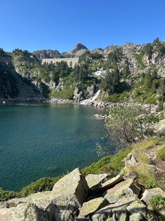
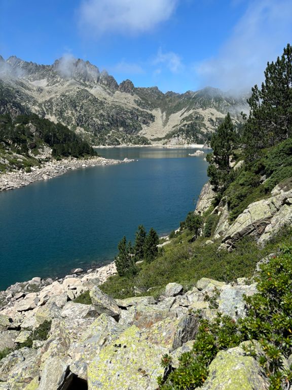
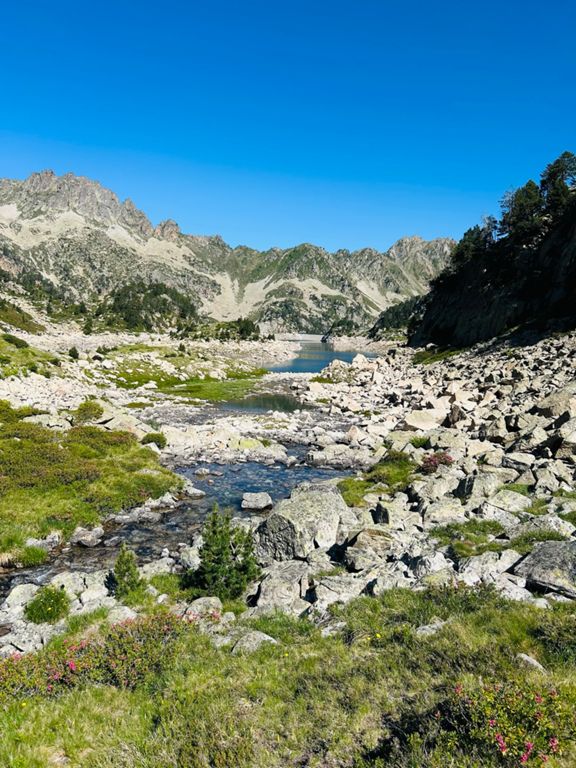
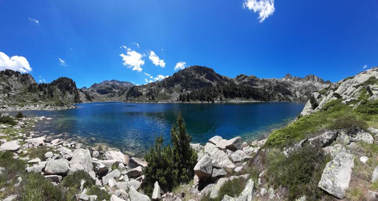
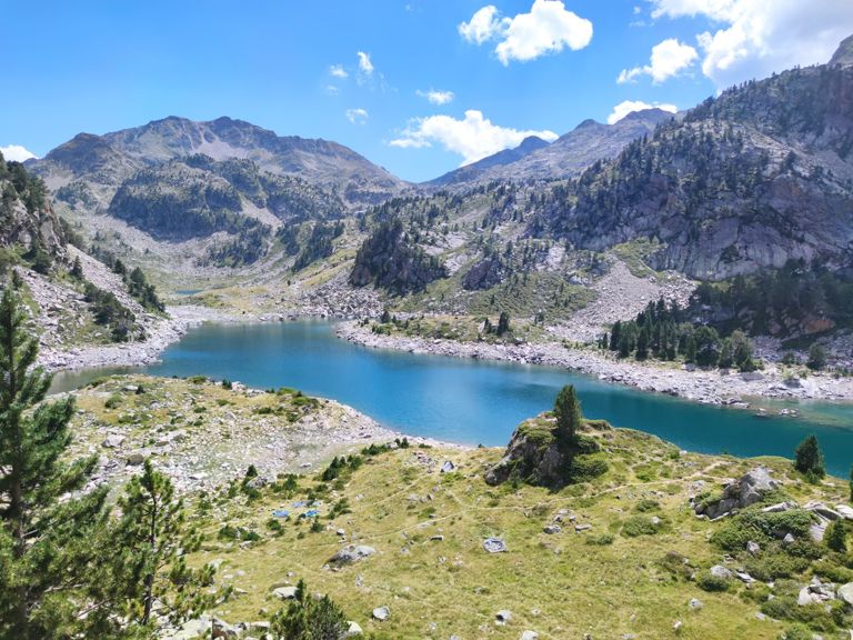
Save yourself the 32 Euros however by tackling this stunning trail route South East of the Pic, climbing from the start (1444m) at the Garet bend car park within the Campan Valley, 870m up to the Refuge du Campana de Cloutou at 2225m. Passing over the icy Le Garet
river, tracing it’s origins to the deep, blue lakes high above, this trail has an estimated hiking time of 3h30 and if the weather is hot you’ll want to throw yourself into one of them.
The Refuge itself is located on the edge of the Neouvielle Nature Reserve, a stunningly diverse part of the Pyrenees mostly made up of rich pine forest and lakes. Blessed with wildlife (ermine, chamois, alpine marmot and both bearded and Egyptian vultures soaring
high above) this region is as remote as you can find and well worth overnighting at the Refuge before descending back to your car.
Covering an elevation of 1000m in 15 minutes and depositing you at an altitude of 2877m, the clear air and endless ocean of Pyrenean peaks are a sight to behold.
Save yourself the 32 Euros however by tackling this stunning trail route South East of the Pic, climbing from the start (1444m) at the Garet bend car park within the Campan Valley, 870m up to the Refuge du Campana de Cloutou at 2225m. Passing over the icy Le Garet
river, tracing it’s origins to the deep, blue lakes high above, this trail has an estimated hiking time of 3h30 and if the weather is hot you’ll want to throw yourself into one of them.
The Refuge itself is located on the edge of the Neouvielle Nature Reserve, a stunningly diverse part of the Pyrenees mostly made up of rich pine forest and lakes. Blessed with wildlife (ermine, chamois, alpine marmot and both bearded and Egyptian vultures soaring
high above) this region is as remote as you can find and well worth overnighting at the Refuge before descending back to your car.
Route and Elevation
Segments
| Name | Distance | Elev. Diff. | Avg. Grade |
|---|---|---|---|
| Rapaillon du Garet | 0.44 km | 112 m | 25.2% |
| Montée réservoir des Laquets D337 20% | 1.43 km | 338 m | 23.5% |
| Avenue du Tourmalet Climb | 0.34 km | 43 m | 12.5% |