Strava
Telemóvel
Funcionalidades
Subscrever
Mapas
Histórias
Registar
Iniciar sessão
+ 46
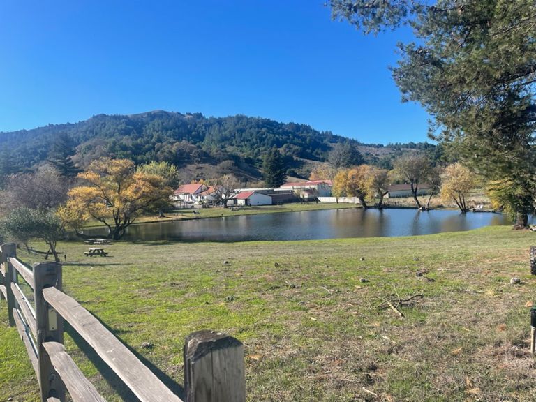
Petaluma coastal route 2
Rota de ciclismo
Guardar
Partilhar
Incorporar
Copiar URL
Exportar TCX
Exportar GPX
Imprimir
Detalhes
50,14 milhas
2 945 pés
Opposite direction, hopefully the wind guides me home
Criado por
Fernando Arellano
27 de agosto de 2015
·
Público
Rota e elevação
Segmentos
Nome
Distância
Dif. Elevação
Inclinação Média
D St ascend
1,44 milhas
236 pés
3,0%
D St to top of Red Hill
6,15 milhas
594 pés
1,8%
sunnyslope to white barn
4,35 milhas
236 pés
0,5%
First D street climb
1,29 milhas
236 pés
3,5%
D st south from Windsor Dr to San Antonio
3,05 milhas
-174 pés
-0,0%
Petaluma Rd San Antonio to Hicks Valley
3,83 milhas
531 pés
1,3%
Red Hill Rd Climb from Petaluma
1,32 milhas
427 pés
6,0%
Red Hill Descent South to Hicks Valley Rd.
1,06 milhas
-220 pés
-3,7%
Hicks Road to Nicasio Valley Road
4,11 milhas
-358 pés
-1,0%
PtReyesPetaluma: NovatoBlvd to Plunge
2,32 milhas
161 pés
1,2%
Hicks Mountain Run
3,75 milhas
-364 pés
-1,0%
Robin's run
2,07 milhas
125 pés
1,2%
Nicasio Res/Flag Hill descent
1,78 milhas
-371 pés
-3,4%
Descent to Nicasio Reservoir
1,63 milhas
-381 pés
-4,0%
Droppin' in to West Marin
4,44 milhas
-489 pés
-2,1%
Point Reyes-Petaluma Descent
0,89 milhas
-282 pés
-6,0%
Nicasio to Tomales
22,22 milhas
-203 pés
-0,1%
Pt Reyes-Pet., fast section
3,85 milhas
-200 pés
-0,6%
Nicasio Dam to Platform Bridge Rd
0,77 milhas
-125 pés
-3,1%
Platform Bridge to Hwy 1 Stop Sign
3,03 milhas
69 pés
0,0%
Platform Bridge to Pt Reyes
1,95 milhas
-62 pés
-0,0%
Point Reyes Station Roaster's Kicker Sprint
0,15 milhas
49 pés
6,1%
Point Reyes Station Kicker Sprint II
0,09 milhas
52 pés
10,9%
Rt 1, Pt Reyes Station to Tony's Seafood, Marshall
7,84 milhas
-138 pés
-0,2%
Pt Reyes to Marshal
9,32 milhas
-128 pés
-0,1%
Pt. Reyes to Tomales
15,28 milhas
-180 pés
-0,1%
Hwy1 Pt Reyes to Marshall (Cypress to Store)
7,32 milhas
-138 pés
-0,2%
14700 to Tomales Oyster Farm
1,86 milhas
26 pés
0,0%
14700 Hwy 1 to Nicks Cove
9,14 milhas
-105 pés
-0,0%
Milerton to Hog Island
5,12 milhas
-98 pés
-0,1%
Marshall to windsurfing parking lot
1,88 milhas
128 pés
0,4%
Highway 1: Marshall to Tomales
6,88 milhas
131 pés
0,1%
flats into tomales
3,51 milhas
112 pés
0,0%
windtunnel take 2
2,10 milhas
-108 pés
-0,9%
Flats from scenic overlook to Tomales Petaluma
2,31 milhas
-82 pés
-0,4%
Jammin"
1,17 milhas
-26 pés
-0,1%
Tomales to Chileno going east
5,12 milhas
171 pés
0,1%
Tomales Rd (complete)
6,75 milhas
135 pés
0,1%
tomales road
3,14 milhas
-85 pés
-0,2%
Tail Winds
1,60 milhas
39 pés
0,4%
Spring Hill - Church to Purvine
2,07 milhas
184 pés
1,2%
Springhill (Full)
7,06 milhas
417 pés
0,2%
Spring Hill Road Climb
5,04 milhas
371 pés
1,3%
Stemer to Purvine
0,65 milhas
144 pés
4,0%
Spring Hill East Purvine to Chileno
5,07 milhas
-266 pés
-0,1%
Spring Hill East Climb
0,42 milhas
102 pés
4,5%
Spring Hill Final Climb
1,02 milhas
236 pés
4,4%
Spring Hill Descent
1,38 milhas
-331 pés
-4,5%
Windsor Drive Petaluma Eastbound
1,30 milhas
-141 pés
-0,9%