


+ 34
Sun6th
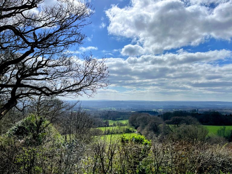
Rota de ciclismo
Detalhes
57,84 milhas
5 042 pés
Hills
Criado por
Jamie w

Rota e elevação
Segmentos
| Nome | Distância | Dif. Elevação | Inclinação Média |
|---|---|---|---|
| Knockholt to Polhill | 2,02 milhas | 184 pés | 1,7% |
| Polhill - Otford Lane to M25 | 0,93 milhas | -171 pés | -3,5% |
| Polhill to Chipstead | 1,52 milhas | -89 pés | -0,7% |
| Star Hill Rd to Sundridge | 2,25 milhas | -92 pés | -0,7% |
| Star Hill to Chipstead Cross | 0,99 milhas | -75 pés | -1,0% |
| Chevening Rd to Coombe Bank Dr | 1,13 milhas | -52 pés | -0,5% |
| Church Road - A25 to Sundridge Road | 1,19 milhas | 299 pés | 4,7% |
| after dropping my gel | 1,73 milhas | 272 pés | 3,0% |
| Norman St Climb | 0,49 milhas | 98 pés | 3,6% |
| 0,36 milhas | 79 pés | 4,0% | |
| Ide Hill Full Descent | 1,02 milhas | -256 pés | -4,7% |
| Another Toys Hill Segment | 0,82 milhas | 118 pés | 2,7% |
| OFFICIAL 100Climbs No20 Toys Hill | 1,61 milhas | 568 pés | 6,7% |
| Toys Hill from the south without the flat bit at the top | 1,36 milhas | 535 pés | 7,4% |
| Toy's Hill Sprint | 0,79 milhas | 240 pés | 5,6% |
| Toys Hill - Final Steep Section | 0,41 milhas | 171 pés | 7,9% |
| 45mph | 1,68 milhas | -436 pés | -4,9% |
| Westerham hill to crockamhill common | 1,91 milhas | 285 pés | 2,7% |
| Hosey Hill | 0,79 milhas | 253 pés | 6,0% |
| Hosey Common Rd (Will's Alpine Climb) | 0,72 milhas | 98 pés | 2,5% |
| Crockham - 4 Elms TT | 1,77 milhas | -184 pés | -1,7% |
| Pootings Road Climb | 0,36 milhas | 46 pés | 2,2% |
| B2027-B2026 | 1,84 milhas | -52 pés | -0,3% |
| Railway Bridge to Station Rd | 0,44 milhas | -26 pés | -1,0% |
| Station/Marlpit Hill Climb | 0,35 milhas | 59 pés | 2,9% |
| Crockham Hill - 40 mph sign to summit | 1,21 milhas | 384 pés | 6,0% |
| Crockham Hill | 0,48 milhas | 217 pés | 8,5% |
| Hosey Turn to Crockham | 0,51 milhas | 138 pés | 5,1% |
| Limpsfield downhill | 0,42 milhas | -85 pés | -3,8% |
| Titsey Full | 2,04 milhas | 518 pés | 4,7% |
| Titsey Hill | 0,89 milhas | 397 pés | 8,4% |
| Titsey Steepest Bit | 0,39 milhas | 243 pés | 11,7% |
| Chalkpit Ln Descent - End at the choke point | 0,70 milhas | -413 pés | -11,1% |
| Hurst Green Road | 0,20 milhas | 43 pés | 3,6% |
| Holland Rd north - south | 0,39 milhas | -43 pés | -2,0% |
| Merle Common Sprint | 0,54 milhas | 79 pés | 2,5% |
| Dwelly Lane | 1,35 milhas | -98 pés | -1,2% |
| Hever Road to left turn. | 1,85 milhas | 49 pés | 0,3% |
| Hever Road | 4,05 milhas | 98 pés | 0,1% |
| Hever Sprint | 0,17 milhas | 33 pés | 3,5% |
| Hever to How Green | 0,60 milhas | 82 pés | 2,4% |
| Hever to Bough Beech | 1,23 milhas | 92 pés | 0,4% |
| How ? | 0,16 milhas | 39 pés | 4,7% |
| Lever outa Hever | 0,05 milhas | 7 pés | 2,6% |
| Bough Beech > Ide Hill Road | 1,74 milhas | 151 pés | 1,4% |
| York's Hill | 1,19 milhas | 404 pés | 6,3% |
| Catford CC Hill Climb | 0,40 milhas | 262 pés | 12,2% |
| The Full Star Hill Climb | 2,52 milhas | 459 pés | 3,3% |
| Morants Mount | 1,22 milhas | 112 pés | 1,7% |
| Star Hill - from waiting point at bottom to factory | 0,75 milhas | 322 pés | 8,1% |