


+ 70
Brushy Creek Trail
Rota de corrida
Moderado
11,36 milhas
179 pés
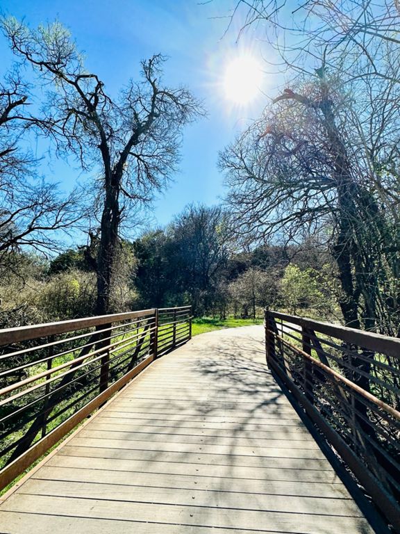
The Brushy Creek Regional Trail is a popular place for runners in north Austin. The 6.75-mile, flat trail is partially paved and part crushed gravel. What the trail lacks in solitude (it parallels a major road for much of the distance), it makes up for in conveniences. Brushy Creek Trail connects several family friendly parks – each with plenty of parking, restrooms and drinking fountains – making this a perfect place for a long out and back run. The trail also offers pretty scenery along the creek, lake and meadows, and it allows you run a fair distance completely off the streets. The trail is not completely shaded so plan your run accordingly during warm weather.
Criado por
Strava Athlete

Rota e elevação
Segmentos
| Nome | Distância | Dif. Elevação | Inclinação Média |
|---|---|---|---|
| Brushy Creek Trail - Bridge Climb | 0,56 milhas | 36 pés | 1,2% |
| Twin Lakes Return Climbs | 1,75 milhas | 72 pés | 0,7% |
| Twin Lakes Final Climb | 0,17 milhas | 46 pés | 3,2% |
| BCRT Mile 1 | 0,99 milhas | -46 pés | -0,9% |
| Twin Lakes to Brushy Creek Lake Park | 3,05 milhas | -62 pés | -0,3% |
| Granite Shoals to Playground | 1,34 milhas | -30 pés | -0,4% |
| Sports Park Speed Trap | 0,72 milhas | -0 pés | 0,0% |
| Lake Park to Champion Park | 1,14 milhas | -62 pés | -0,9% |
| Brushy Creek Train: Meadow Park to Brushy Dam | 1,91 milhas | 79 pés | 0,7% |
| Champion Park to Lake Park | 1,13 milhas | 62 pés | 0,9% |
| Damn Hill Repeat Segment | 0,37 milhas | 46 pés | 2,3% |
| Up to the Dam | 0,36 milhas | 46 pés | 2,4% |
| Up to the Dam | 0,36 milhas | 46 pés | 2,3% |
| Damn Hill | 0,07 milhas | 23 pés | 4,8% |