


+ 103
Exeter College Staff November MTB Social (Around the Teign)
Cycling Route
Details
15.53 mi
1,445 ft
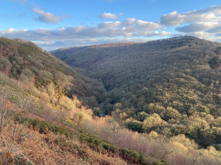
Starting at Steps Bridge Car Park we will head down the bridleway along the river to Fingle Bridge Inn, for a quick stop off and refuel if needed. We will then head along fisherman's path, before crossing the footbridge at Hunters Tor, onto Hunters Path, with some breathtaking views over Castle Drogo, and a chance to see the whole Teign Valley if your brave enough! a few tricky rocks (feel free to walk if needed) before a short 1 mile very fast twisty descent, (or walk) straight back to the pub. Then back along the Teign to our starting point. all in all a nice scenic gentle 15 mile MTB ride.
Created By
Chris Chapman

Route and Elevation
Segments
| Name | Distance | Elev. Diff. | Avg. Grade |
|---|---|---|---|
| River Teign Jaunt | 1.81 mi | 157 ft | 0.4% |
| OLD VERSION - Hunters path (west to east.) | 1.78 mi | -312 ft | -2.3% |
| Hunters path (west to east.) | 1.75 mi | -312 ft | -2.2% |
| Drogo Climb | 1.22 mi | 157 ft | 2.3% |
| Drogo - Hunters Path | 1.56 mi | -315 ft | -1.4% |
| Hunter's Path - Fingle Bridge Descent | 0.38 mi | -249 ft | -8.9% |
| Return to Steps Bridge | 1.71 mi | -43 ft | -0.4% |