| German Town Hill | 1.56 公里 | 95 公尺 | 6.1% |
| Freeway - Bollards to Tollgate | 8.69 公里 | -399 公尺 | -4.6% |
| barrier to elbow | 4.69 公里 | -203 公尺 | -4.0% |
| Eagle Park esses | 0.68 公里 | -43 公尺 | -6.4% |
| Rawson Penfold Dr Climb | 2.70 公里 | 88 公尺 | 3.2% |
| The Parade - Glynburn Rd to Penfold Rd | 1.59 公里 | 51 公尺 | 3.2% |
| Magill to first switchback | 2.07 公里 | 112 公尺 | 5.4% |
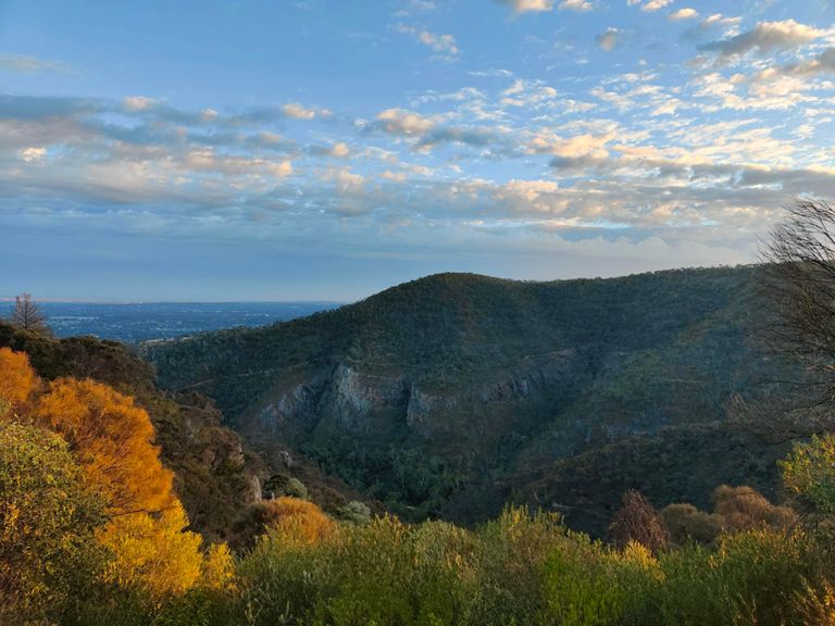
| Norton Summit to Mt Lofty | 16.00 公里 | 549 公尺 | 3.4% |
| Norton Summit | 5.48 公里 | 277 公尺 | 5.0% |
| Norton - 1st 500mtrs | 0.51 公里 | 22 公尺 | 4.2% |
| Norton - 1st km from bridge | 0.95 公里 | 56 公尺 | 5.8% |
| The Eternal Twin Towers Power Climb! | 0.12 公里 | 7 公尺 | 5.3% |
| Norton - 2nd 500mtrs | 0.48 公里 | 27 公尺 | 5.6% |
| Norton 1stk | 1.02 公里 | 54 公尺 | 5.2% |
| Norton - 3rd 500mtrs | 0.53 公里 | 28 公尺 | 5.2% |
| Norton - 4th 500mtrs | 0.50 公里 | 29 公尺 | 5.8% |
| Norton Summit - Middle 2km | 1.89 公里 | 102 公尺 | 5.4% |
| Norton 1st Switch | 0.28 公里 | 15 公尺 | 5.3% |
| Aaron's Secret Repeat Section (Shhh!) | 0.97 公里 | 56 公尺 | 5.7% |
| Norton top half | 4.05 公里 | 204 公尺 | 4.5% |
| Norton - 6th 500mtrs | 0.56 公里 | 34 公尺 | 6.0% |
| Norton 2nd Switch | 0.23 公里 | 14 公尺 | 5.8% |
| Ridgeland Dr Climb | 0.95 公里 | 100 公尺 | 10.4% |
| Norton - 7th 500mtrs | 0.50 公里 | 56 公尺 | 11.2% |
| Norton - 8th 500mtrs | 0.52 公里 | -38 公尺 | -4.6% |
| Norton 3rd Switch | 0.67 公里 | 31 公尺 | 4.6% |
| Sprint to Teringie | 0.36 公里 | -28 公尺 | -5.9% |
| Norton Summit - Last 1.5km | 1.44 公里 | 59 公尺 | 4.1% |
| Norton - 9th 500mtrs | 0.50 公里 | 52 公尺 | 10.2% |
| Norton - 10th 500mtrs | 0.42 公里 | 31 公尺 | 7.3% |
| Last 700 mtrs to the Oak tree | 0.72 公里 | 25 公尺 | 3.4% |
| Through the trail walkers' car park | 0.40 公里 | 24 公尺 | 4.3% |
| Final Sprint to the Oak Tree | 0.46 公里 | 17 公尺 | 3.6% |
| Sprint to the Oak tree then keep it going to the crest! | 0.97 公里 | 28 公尺 | 1.6% |
| Just when you thought it was over.. | 1.76 公里 | 34 公尺 | 1.5% |
| Oak tree to crest | 0.59 公里 | 20 公尺 | 1.8% |
| Cresting! | 0.20 公里 | 7 公尺 | 3.1% |
| Last effort - go hard | 0.10 公里 | 3 公尺 | 3.1% |
| Norton - last 1km to township | 1.01 公里 | -30 公尺 | -0.5% |
| short climb to Woods Hill Rd | 0.21 公里 | 16 公尺 | 7.4% |
| Woods Hill | 0.65 公里 | 51 公尺 | 7.7% |
| Woods Hill Rd - Full | 1.86 公里 | 77 公尺 | 4.1% |
| Woods Hill Rd to Lofty | 7.35 公里 | 196 公尺 | 2.6% |
| Summit Rd (Greenhill to Gates) | 3.06 公里 | 93 公尺 | 3.0% |
| Steep Summit | 0.34 公里 | 19 公尺 | 5.7% |
| Cleland Kicker | 0.99 公里 | 54 公尺 | 5.4% |
| Up we go | 0.13 公里 | 20 公尺 | 15.4% |
| Gates to Crafers | 2.48 公里 | -127 公尺 | -4.6% |
| Summit Rd Downhill Burn | 1.16 公里 | -87 公尺 | -7.5% |
| Mt Barker Road - Leaving Hahndorf | 2.23 公里 | 92 公尺 | 4.1% |