route-highlight
route-highlight
route-highlight
route-highlight
route-highlight
route-highlight
+ 81

Marin Headlands

Rota de Corrida

Alto
8,43 mi
1.912 pés
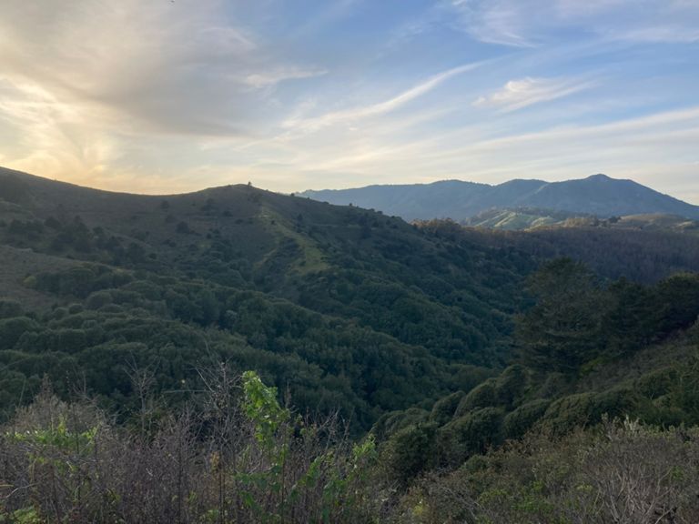
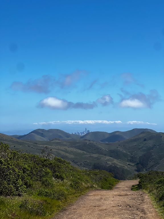
The Marin Headlands boasts some of the most spectacular sights in the Bay Area. Those tenacious enough to run nearly 1,000 feet to the top of the Headlands will be rewarded with a panoramic view from the Farallon Islands in the Pacific to Mt. Diablo in the East Bay, as well as San Francisco and Pacifica beyond. The Headlands are excellent for running because the trails are well marked, making it hard to get lost, and there are many ways to modify your route to either extend or shorten your run. Be forewarned that the climbs here are no joke; many are a mile long and over 600 feet up. The highlight of this route is the section through Pirates Cove where the trail hugs low along the coastline and you can watch the waves crashing in against the rocks. Tennessee Valley is a great place to start because of its close proximity to the highway. There are restrooms here but no water so bring your own. Lots of local running and hiking groups like to meet here, so arrive early on the weekends to get a good parking spot. If you are in need of nutrition or gear for your run, the San Francisco Running Company is very close by on Shoreline Highway.
Criado por
K A

Rota e elevação

Segmentos

NomeDistânciaDif. de elev.Inclinação média
Tennessee Valley to Muir Beach via Pirates Cove3,73 mi-492 pés-0,6%
Middle Green Gulch Loop8,45 mi1.010 pés0,0%
Tennessee Valley to Muir Beach (via Pirates Cove)3,87 mi-545 pés-0,8%
Tennessee Valley (Miwok to Coastal)1,18 mi-115 pés-1,7%
Chapparal Tr Climb0,20 mi207 pés18,9%
Take off0,90 mi499 pés10,1%
Coastal Trail (Tennessee Valley to Pirates Cove Trail)0,64 mi453 pés13,2%
Coastal (Tennessee Valley to Coastal Fire Road)2,15 mi453 pés2,6%
coastal white post hill sprint0,05 mi62 pés20,8%
Coastal (Tennessee Valley to Coyote Ridge)0,65 mi436 pés12,5%
Pirates Cove Trail - North1,47 mi-417 pés-2,0%
Coastal through Pirate's Cove Northbound1,42 mi-400 pés-1,8%
Coastal Fire Road to Pirates Cove 0,33 mi-390 pés-21,9%
Coastal Fire Road (Pirates Cove Trail to Kaasi Road)0,52 mi-384 pés-13,9%
Coastal (Coyote->Muir) Descent0,52 mi-387 pés-13,9%
Middle Green Gulch to cut-off1,30 mi528 pés7,6%
Middle Green Gulch Trail Climb0,23 mi161 pés12,9%
Up Middle Green Gulch1,68 mi827 pés9,3%
MGG gate to last hairpin0,24 mi171 pés12,9%
MGG Up (cut the ends off)1,67 mi810 pés9,1%
M Green Gulch (Zen Entrance to Steeps)1,06 mi482 pés8,6%
Green Gulch Midway0,34 mi236 pés13,0%
Coyote Ridge (Miwok Cut-off to Summit)0,32 mi79 pés4,6%
Final Sprint to the top0,14 mi75 pés10,3%
Coyote Ridge (Summit to Miwok Cut-off)0,58 mi-190 pés-5,9%
Miwok Shortcut (Eastbound)0,28 mi-98 pés-6,5%
Miwok Bump0,12 mi39 pés5,5%
Miwok Descent to Tenn Valley0,87 mi-509 pés-10,2%