


+ 154
Col de la Forclaz MON 85km 2125m
Cycling Route
Details
78.55 km
2,224 m
85 km, 2125 m vertical
Assemble at 08:45 for departure at 09:00.
After a short warm-up in the village we begin our week’s cycling in the Alps by heading straight up the Col de la Croix Fry (1467 m) from its easier eastern side. We cross the col after 8 km and 400 m vertical and begin the fast descent through Manigod to the bottom of the valley, where we turn left and climb easily to the Col du Marais (843 m). The straightforward descent has fantastic views across the valley to Saint Ferreol, the lowest point of the day at 500 m.
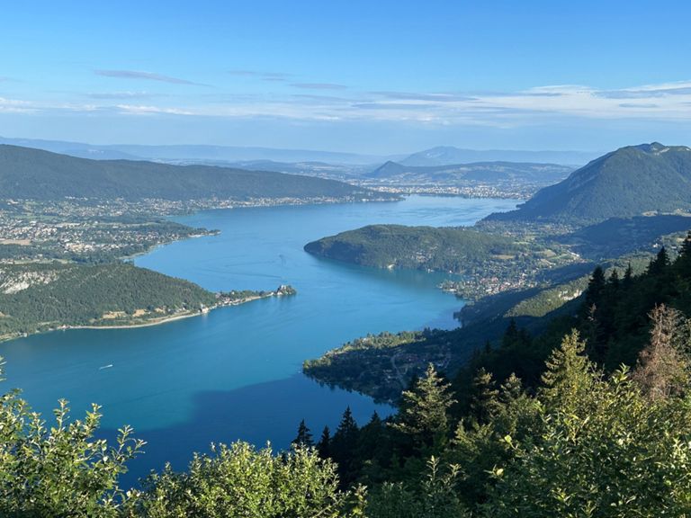
After a couple of kilometres in the forest we attack the climb to the Col de la Forclaz (1157 m), with its extraordinary views over Annecy and the lake far below. Here the view is well and truly earned: the climb averages 8% and has several sections at 12-13%.
The descent to Talloires is steep, followed by a gentle rise to Bluffy and a further descent to cross the river Fier. There remains just 20 km and 500 m vertical to climb back to La Clusaz through Thônes and St Jean-de-Sixt.
Back at the hotel between 12.30 and 1 pm.
Assemble at 08:45 for departure at 09:00.
After a short warm-up in the village we begin our week’s cycling in the Alps by heading straight up the Col de la Croix Fry (1467 m) from its easier eastern side. We cross the col after 8 km and 400 m vertical and begin the fast descent through Manigod to the bottom of the valley, where we turn left and climb easily to the Col du Marais (843 m). The straightforward descent has fantastic views across the valley to Saint Ferreol, the lowest point of the day at 500 m.
After a couple of kilometres in the forest we attack the climb to the Col de la Forclaz (1157 m), with its extraordinary views over Annecy and the lake far below. Here the view is well and truly earned: the climb averages 8% and has several sections at 12-13%.
The descent to Talloires is steep, followed by a gentle rise to Bluffy and a further descent to cross the river Fier. There remains just 20 km and 500 m vertical to climb back to La Clusaz through Thônes and St Jean-de-Sixt.
Back at the hotel between 12.30 and 1 pm.
Created By
Guy D
