
Últimas duas semanas
Mês passado


+ 114
GBJ - Day 3
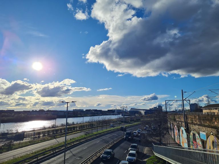
Rota de ciclismo
Detalhes
111,42 milhas
5 432 pés
Criado por
Rich Tindale - ride2

Rota e elevação
Segmentos
| Nome | Distância | Dif. Elevação | Inclinação Média |
|---|---|---|---|
| A82 - Auch | 4,18 milhas | 499 pés | 2,2% |
| Down to Tyndrum Junction | 1,65 milhas | -256 pés | -2,9% |
| Tyndrum to Crianlarich | 4,12 milhas | -197 pés | -0,9% |
| Cruin to Cameron House | 0,63 milhas | 46 pés | 0,6% |
| Bonhill Climb | 0,15 milhas | 49 pés | 6,1% |
| That horrible effort on the way to work! | 1,71 milhas | -105 pés | -0,3% |
| Strathleven to Bellsmyre | 0,90 milhas | -95 pés | -1,5% |
| "hill" interval, lol | 0,48 milhas | 20 pés | 0,4% |
| Harbour to School | 0,61 milhas | 36 pés | 0,8% |
| Old Kilpatrick Mile | 1,03 milhas | -43 pés | -0,5% |
| THE DALMUIR DIRK DIGGLER | 0,35 milhas | -7 pés | -0,2% |
| Dalmuir To Kilbowie Road | 1,80 milhas | -30 pés | -0,1% |
| Duntocher Rd to Kilbowie Rd | 0,97 milhas | -16 pés | -0,1% |
| Beardmore Street to Hawick Street | 1,99 milhas | 23 pés | 0,0% |
| Kilbowie Road To Dumbarton Road | 2,01 milhas | 26 pés | 0,1% |
| North Elgin Street To Kelso Street | 0,78 milhas | -7 pés | -0,0% |
| South Street | 2,38 milhas | -49 pés | -0,0% |
| intervalish | 3,70 milhas | 13 pés | 0,0% |
| Smash the Gremlin | 0,39 milhas | -16 pés | -0,6% |
| Fore st to Edzell st | 0,25 milhas | 7 pés | 0,3% |
| riverside road lights to helipad | 0,74 milhas | -23 pés | -0,3% |
| Beat the Lights? | 0,19 milhas | -16 pés | -1,1% |
| SECC SMASH | 0,88 milhas | 23 pés | 0,2% |
| Squinty_Sprinty | 0,39 milhas | 7 pés | 0,1% |
| clyde-side sprint | 0,67 milhas | 30 pés | 0,3% |
| Bus Lane East | 0,40 milhas | 26 pés | 0,6% |
| High Court Approach | 0,22 milhas | -20 pés | -1,0% |
| Glasgow Green Cobble Sprint | 0,37 milhas | 16 pés | 0,4% |
| Alongside the Green - away from town | 0,27 milhas | -26 pés | -1,9% |
| Tip Sprint | 0,30 milhas | 0 pés | 0,0% |
| Lidl to Dukes Rd | 0,42 milhas | 13 pés | 0,5% |
| Fratellis to Cambuslang Station | 0,41 milhas | 56 pés | 2,6% |
| Lights- Sprint up to the Bridge | 0,35 milhas | 30 pés | 1,4% |
| Circuit Escape | 0,70 milhas | 39 pés | 1,0% |
| Halfway-Blantyre | 1,75 milhas | 79 pés | 0,3% |
| Manse brae - Burnbank | 2,76 milhas | -62 pés | -0,2% |
| Glasgow Road roulette | 1,18 milhas | -30 pés | -0,1% |
| Car wash to lights | 0,89 milhas | -46 pés | -0,1% |
| Burnbank | 1,39 milhas | 72 pés | 0,5% |
| First Bus climb | 0,35 milhas | 33 pés | 1,6% |
| Burnbank Bypass | 0,26 milhas | -10 pés | -0,3% |
| Burnbank Road to lights | 0,39 milhas | 36 pés | 1,3% |
| OLD VERSION - Rise from Avon bridge to Chatelherault bus stop | 0,50 milhas | 92 pés | 3,5% |
| carlisle rd | 1,15 milhas | 82 pés | 1,1% |
| Carlisle Rise | 0,50 milhas | 56 pés | 2,1% |
| Larkhall-Lesmahagow | 7,85 milhas | 295 pés | 0,6% |
| SLB-Canderside toll | 0,53 milhas | 62 pés | 2,1% |
| Canderside to Blackwood | 3,21 milhas | 112 pés | 0,4% |
| up past gow old 74 | 0,56 milhas | 125 pés | 4,2% |
| Out | 4,76 milhas | -121 pés | -0,2% |