
Últimas duas semanas


+ 194
2017 Marin Century: Mt Tam Climbing Course
Rota de ciclismo
Detalhes
95,74 milhas
7 950 pés
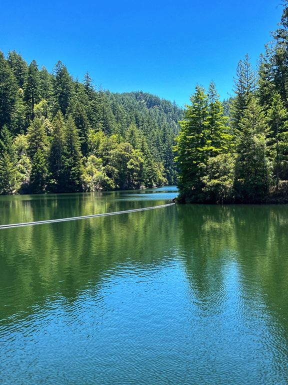
2017 Marin Century: Mt Tam climbing course. Route is roughly 4 miles short of 100 miles, might need to find a few side roads to round up to 100.
Shortly after Stinson Beach Rest Stop there are a couple shoreline roads to explore and help round up to 100 miles.
Shortly after Stinson Beach Rest Stop there are a couple shoreline roads to explore and help round up to 100 miles.
Criado por
Mark K

Rota e elevação
Segmentos
| Nome | Distância | Dif. Elevação | Inclinação Média |
|---|---|---|---|
| Bottom of Big Rock Hill to Summit | 0,93 milhas | 384 pés | 7,8% |
| Top Big Rock East to NVR | 4,83 milhas | -427 pés | -1,6% |
| Whites Hill | 2,09 milhas | 246 pés | 2,2% |
| White's Hill (Eastbound) | 0,63 milhas | 161 pés | 4,7% |
| Whites (just the tip) | 0,22 milhas | 85 pés | 7,0% |
| White's Hill Good DH Only | 0,89 milhas | -374 pés | -7,9% |
| White's Hill Summit to Fairfax | 2,14 milhas | -446 pés | -3,9% |
| White's Hill Descent | 1,07 milhas | -328 pés | -5,8% |
| Sir Francis Drake Fairfax Sprint | 0,91 milhas | -62 pés | -1,3% |
| DT fairfax to Meadow Club | 2,45 milhas | 607 pés | 4,7% |
| fairfax 1 mile climb | 0,93 milhas | 154 pés | 2,5% |
| Pine Mtn. Pass | 3,39 milhas | 955 pés | 5,3% |
| Fairfax + Seven Sisters | 12,52 milhas | 1 913 pés | 2,8% |
| Fairfax(Bolinas Rd) to Alpine Dam entrance | 7,39 milhas | 948 pés | 1,4% |
| That first half mile | 0,44 milhas | 167 pés | 7,2% |
| Bolinas Rd to Sky Oaks Rd | 0,85 milhas | 371 pés | 8,2% |
| Final pitch to Sky Oaks | 0,47 milhas | 190 pés | 7,5% |
| Meadow Club to Pine Mt. Climb | 1,21 milhas | 344 pés | 5,4% |
| BHR Medow Club | 0,49 milhas | 164 pés | 6,4% |
| Pine Mountain - Final Sprint | 0,26 milhas | 79 pés | 5,8% |
| Tam Cen rest stop 2 Westridge T (gt) | 6,57 milhas | 837 pés | 1,2% |
| Pine Mt to Alpine Dam | 4,04 milhas | -423 pés | -2,0% |
| BoFax Dip | 1,10 milhas | -295 pés | -5,0% |
| Bolinas Bump #1 | 0,35 milhas | 89 pés | 4,7% |
| Last Dam Kicker | 0,54 milhas | 118 pés | 3,9% |
| Alpine Dam + Seven Sisters | 6,17 milhas | 1 391 pés | 4,1% |
| Alpine Dam to Ridgecrest Climb | 2,01 milhas | 820 pés | 7,7% |
| BoFax Transistor Radio | 1,53 milhas | 230 pés | 2,5% |
| Seven Sisters to East Peak | 6,73 milhas | 1 014 pés | 2,3% |
| Seven Sisters | 3,72 milhas | 558 pés | 2,3% |
| Sister 5 and 6 | 0,70 milhas | 315 pés | 8,5% |
| sister5steep | 0,28 milhas | 144 pés | 9,6% |
| Top Sister Sprint | 0,37 milhas | 92 pés | 3,7% |
| Sister 7 Tiffany | 1,20 milhas | -85 pés | -0,5% |
| Tam finish sprint | 0,09 milhas | 26 pés | 4,8% |
| Tam - Ranger Station to Summit | 1,34 milhas | 482 pés | 6,8% |
| Last punch in the gut | 0,26 milhas | 108 pés | 8,0% |
| East Peak Final Pitch | 0,17 milhas | 95 pés | 10,5% |
| intervallissimo climactica | 0,09 milhas | 39 pés | 8,0% |
| East Peak - Pantoll | 4,17 milhas | -945 pés | -3,3% |
| East Peak to West Peak Climb | 1,28 milhas | 240 pés | 3,2% |
| red line climb | 0,42 milhas | 180 pés | 8,1% |
| West Peak to Pantoll | 2,89 milhas | -991 pés | -6,4% |
| Top of Tam to ranger | 1,42 milhas | -499 pés | -6,6% |
| Rock Springs to Pantoll | 1,30 milhas | -417 pés | -6,1% |
| Pan Toll to Stinson Descent | 3,42 milhas | -1322 pés | -7,3% |
| Stinson to base of BoFax (Tam Hill Climb Course) | 4,34 milhas | -20 pés | -0,1% |
| Stinson to Olema | 13,36 milhas | 466 pés | 0,1% |
| Dogtown Climb | 0,89 milhas | 282 pés | 5,9% |
| Drake Road climb to Olema | 0,72 milhas | 289 pés | 7,5% |